
Plik:Plan of London in 1300.jpg

Rozmiar pierwotny (1080 × 842 pikseli, rozmiar pliku: 879 KB, typ MIME: image/jpeg)
| Plik Plan of London in 1300.jpg znajduje się w Wikimedia Commons – repozytorium wolnych zasobów. Dane z jego strony opisu znajdują się poniżej. |
Opis
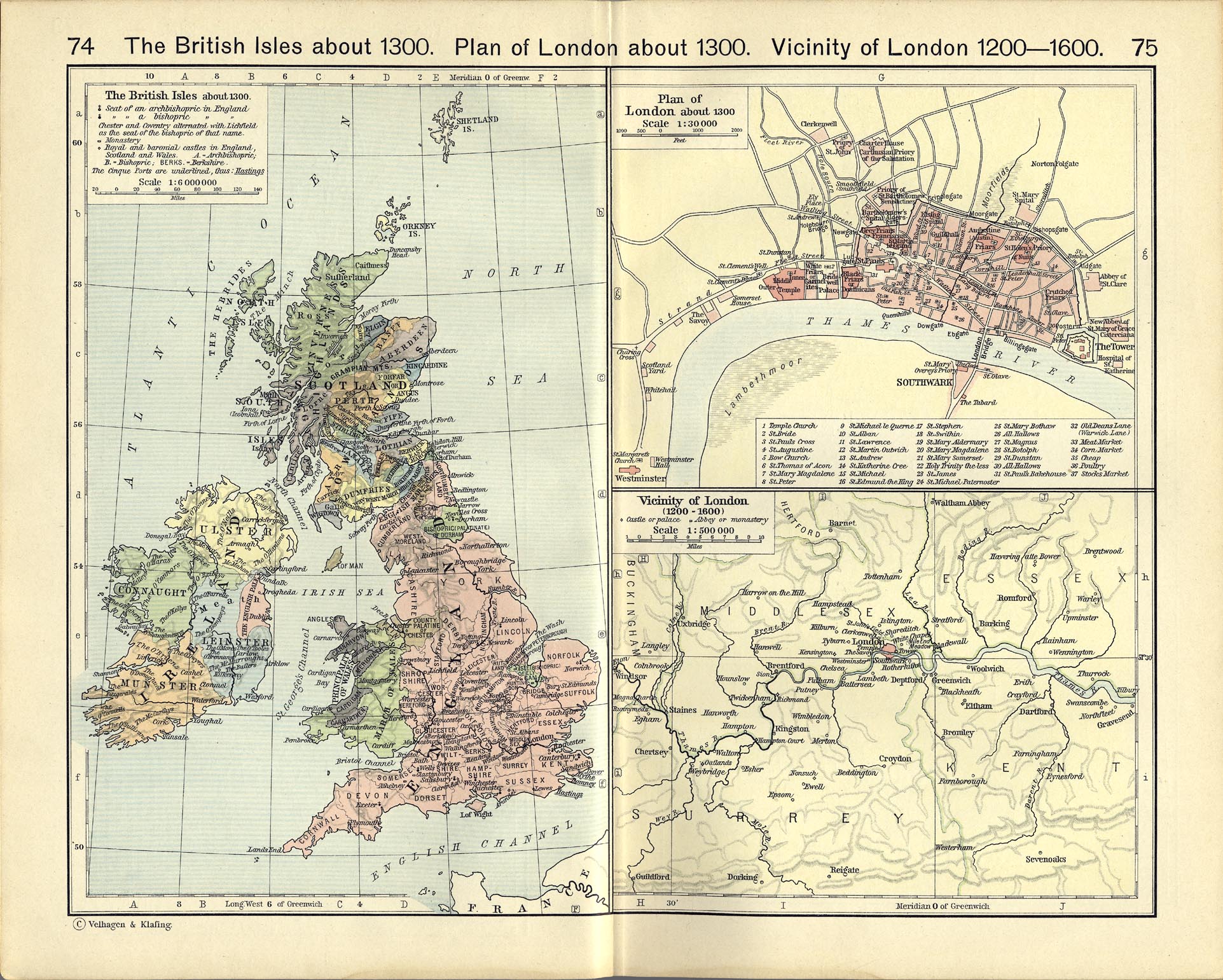
| Opis | A plan drawn up in 1926 of how London may have appeared in 1300. | |||
| Data | ||||
| Źródło | Shepherd, William R. (1926) Historical Atlas. Henry Holt and Company. A copy is on the Perry-Castañeda Library website. | |||
| Autor | William R. Shepherd | |||
| Inne wersje |
File:London 1300 Historical Atlas William R Shepherd (died 1934).PNG
|


.PNG)
http://www.worldcat.org/title/historical-atlas/oclc/862316
Book published in 1926 by Henry Holt-proof of US publication and year of publication.
https://legacy.lib.utexas.edu/maps/historical/shepherd_1911/shepherd-c-074-075.jpg
Map is on page 75 upper portion.
Renewal searches were done for the years 1953 and 1954 in books and maps. There were no listings in maps for London, Holt, Shepherd or Velhagen & Klafing (seen at lower left of pp 74-75).
Henry Holt Company renewed only one book in 1953 "The Growth of Biology". William Shepherd was not listed; the companies Frank Shepherd and Shepherd's Citations were but they are not related. In 1954 Ernest and Arthur Shepherd renewed books as well as Frank Shepherd Company and Shepherd's Citations; they are not related. There's no evidence of renewal for the atlas or the map.
Licencja
This work is in the public domain because it was published in the United States between 1929 and 1963, and although there may or may not have been a copyright notice, the copyright was not renewed. For further explanation, see Commons:Hirtle chart and the copyright renewal logs. Note that it may still be copyrighted in jurisdictions that do not apply the rule of the shorter term for US works (depending on the date of the author's death), such as Canada (70 years p.m.a.), Mainland China (50 years p.m.a., not Hong Kong or Macao), Germany (70 years p.m.a.), Mexico (100 years p.m.a.), Switzerland (70 years p.m.a.), and other countries with individual treaties.
|
 |
|
Ten materiał przeszedł do domeny publicznej w kraju pochodzenia, jak również w państwach i terytoriach, gdzie prawo autorskie wygasa w ciągu 70 lat po śmierci autora.
| |
| Plik rozpoznano jako wolny od znanych ograniczeń praw autorskich, włącznie z prawami zależnymi i pokrewnymi. | |
Historia pliku
Kliknij na datę/czas, aby zobaczyć, jak plik wyglądał w tym czasie.
| Data i czas | Miniatura | Wymiary | Użytkownik | Opis | |
|---|---|---|---|---|---|
| aktualny | 09:35, 15 lut 2011 | | 1080 × 842 (879 KB) | Gump Stump | Crop, adjustments (color, levels) |
| 15:57, 21 lip 2010 |  | 1140 × 902 (236 KB) | Nev1 | {{Information |Description=A plan of how London appeared in 1300. |Source=Shepherd, William R. (1926) ''Historical Atlas''. Henry Holt and Company. A copy is on the [http://www.lib.utexas.edu/maps/historical/history_shepherd_1923.html Perry-Castañeda Lib |
Lokalne wykorzystanie pliku
Następujące strony korzystają z tego pliku:
Globalne wykorzystanie pliku
Ten plik jest wykorzystywany także w innych projektach wiki:
- Wykorzystanie na de.wikipedia.org
- Wykorzystanie na en.wikipedia.org
- Wykorzystanie na ms.wikipedia.org
- Wykorzystanie na ru.wikipedia.org
- Wykorzystanie na sr.wikipedia.org