
Plik:Slave and Free States before the American Civil War.svg

Wielkość pliku podglądu PNG dla pliku SVG: 800 × 502 pikseli Inne rozdzielczości: 320 × 201 pikseli | 640 × 401 pikseli | 1024 × 642 pikseli | 1280 × 803 pikseli | 2560 × 1605 pikseli | 882 × 553 pikseli.
Rozmiar pierwotny (Plik SVG, nominalnie 882 × 553 pikseli, rozmiar pliku: 105 KB)
| Plik Slave and Free States before the American Civil War.svg znajduje się w Wikimedia Commons – repozytorium wolnych zasobów. Dane z jego strony opisu znajdują się poniżej. |
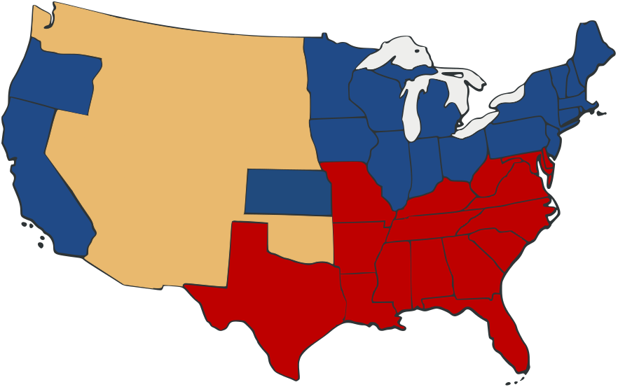
| Opis | Free and Slave States in the period leading to the American Civil War. Free states are blue, slave states in red. Territories are a neutral yellow. | ||
| Data | |||
| Źródło | Based on Image:US_Secession_map_1865.svg with information from en:Image:Freeandslavestates.gif | ||
| Autor | Self-made from public domain work Image:US_Secession_map_1865.svg | ||
| Licencja (Ponowne użycie tego pliku) |
|
||
| Inne wersje |
 |
Historia pliku
Kliknij na datę/czas, aby zobaczyć, jak plik wyglądał w tym czasie.
| Data i czas | Miniatura | Wymiary | Użytkownik | Opis | |
|---|---|---|---|---|---|
| aktualny | 01:05, 28 wrz 2007 | | 882 × 553 (105 KB) | Adam Cuerden | Fixed the borders in th e territories by muckin' 'em around. |
| 00:59, 28 wrz 2007 |  | 882 × 553 (104 KB) | Adam Cuerden | {{Information |Description= |Source= Based on Image:US_Secession_map_1865.svg with information from en:Image:Freeandslavestates.gif |Date=2007 |Author=Self-made from public domain work Image:US_Secession_map_1865.svg |Permission={{PD-retouc |
Lokalne wykorzystanie pliku
Następujące strony korzystają z tego pliku:
Globalne wykorzystanie pliku
Ten plik jest wykorzystywany także w innych projektach wiki:
- Wykorzystanie na de.wikipedia.org
- Wykorzystanie na en.wikipedia.org
- Wykorzystanie na fr.wikipedia.org
- Wykorzystanie na io.wikipedia.org
- Wykorzystanie na it.wikipedia.org
- Wykorzystanie na la.wikipedia.org
- Wykorzystanie na no.wikipedia.org