
Plik:New York's Finger Lakes.jpg

Rozmiar podglądu – 800 × 554 pikseli. Inne rozdzielczości: 320 × 222 pikseli | 640 × 444 pikseli | 1000 × 693 pikseli.
Rozmiar pierwotny (1000 × 693 pikseli, rozmiar pliku: 952 KB, typ MIME: image/jpeg)
| Plik New York's Finger Lakes.jpg znajduje się w Wikimedia Commons – repozytorium wolnych zasobów. Dane z jego strony opisu znajdują się poniżej. |
| Opis |
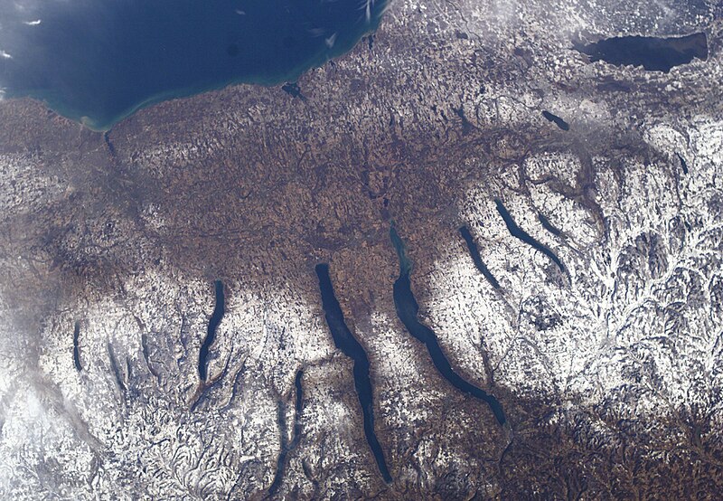
New York's Finger Lakes |
| Data | |
| Źródło | NASA |
| Autor | NASA |
Ta grafika lub film został skatalagowany przez jeden z ośrodków Stanów Zjednoczonych Ameryki National Aeronautics and Space Administration (NASA)pod Photo ID: ISS010-E-9366. Ten szablon nie wskazuje stanu prawnego pliku. Standardowy szablon licencji jest nadal wymagany. Aby dowiedzieć się więcej, zajrzyj na stronę Commons:Licencja. Inne języki:
|
| Ten plik jest w domenie publicznej ponieważ został stworzony przez NASA. Polityka praw autorskich NASA stwierdza, że „materiały NASA nie są chronione prawami autorskimi, chyba że zapisano inaczej”. (NASA copyright policy lub JPL Image Use Policy). | ||
 |
Uwaga:
|
Historia pliku
Kliknij na datę/czas, aby zobaczyć, jak plik wyglądał w tym czasie.
| Data i czas | Miniatura | Wymiary | Użytkownik | Opis | |
|---|---|---|---|---|---|
| aktualny | 05:39, 24 gru 2004 | | 1000 × 693 (952 KB) | Chris 73 | nasa |
Lokalne wykorzystanie pliku
Następujące strony korzystają z tego pliku:
Globalne wykorzystanie pliku
Ten plik jest wykorzystywany także w innych projektach wiki:
- Wykorzystanie na ar.wikipedia.org
- Wykorzystanie na azb.wikipedia.org
- Wykorzystanie na bg.wikipedia.org
- Wykorzystanie na ca.wikipedia.org
- Wykorzystanie na cs.wikipedia.org
- Wykorzystanie na de.wikipedia.org
- Wykorzystanie na en.wikipedia.org
- Wykorzystanie na en.wikivoyage.org
- Wykorzystanie na es.wikipedia.org
- Wykorzystanie na fa.wikipedia.org
- Wykorzystanie na fr.wikipedia.org
- Wykorzystanie na he.wikipedia.org
- Wykorzystanie na he.wikivoyage.org
- Wykorzystanie na it.wikipedia.org
- Wykorzystanie na ja.wikipedia.org
- Wykorzystanie na lfn.wikipedia.org
- Wykorzystanie na ml.wikipedia.org
- Wykorzystanie na mr.wikipedia.org
- Wykorzystanie na nl.wikipedia.org
- Wykorzystanie na ru.wikipedia.org
- Wykorzystanie na simple.wikipedia.org
- Wykorzystanie na sv.wikipedia.org
- Wykorzystanie na ta.wikipedia.org
- Wykorzystanie na uk.wikipedia.org
- Wykorzystanie na vi.wikipedia.org
- Wykorzystanie na www.wikidata.org
- Wykorzystanie na zh.wikivoyage.org