
Plik:Three Gorges Dam, China.jpg

Rozmiar pierwotny (3072 × 2039 pikseli, rozmiar pliku: 1,42 MB, typ MIME: image/jpeg)
| Plik Three Gorges Dam, China.jpg znajduje się w Wikimedia Commons – repozytorium wolnych zasobów. Dane z jego strony opisu znajdują się poniżej. |
Opis
| Opis |
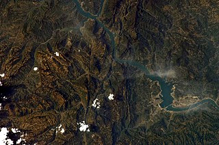
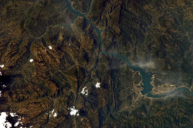
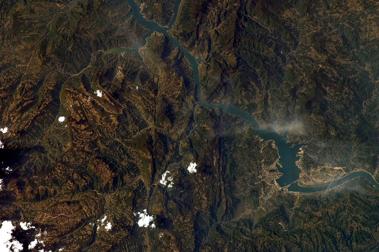
English: This image captures the flooding behind the Three Gorges Dam (north is up).
This photograph was acquired with a Nikon 2DXs digital camera fitted with a 180 mm lens, and is provided by the ISS Crew Earth Observations experiment and Image Science & Analysis Laboratory, Johnson Space Centre. Instrument: ISS - Digital Camera
|
||||||||||||||||||||||||||||||||||||||||||||||||||||||
| Data | |||||||||||||||||||||||||||||||||||||||||||||||||||||||
| Źródło | NASA Earth Observatory | ||||||||||||||||||||||||||||||||||||||||||||||||||||||
| Autor | This image was taken by the NASA Expedition 19 crew. | ||||||||||||||||||||||||||||||||||||||||||||||||||||||
| Inne wersje | File:Three Gorges Dam on the Yangtze River.jpg | ||||||||||||||||||||||||||||||||||||||||||||||||||||||
| Pozycja fotografa | | To i inne zdjęcia na: OpenStreetMap |
|---|
Ta grafika lub film został skatalagowany przez Johnson Space Center Stanów Zjednoczonych Ameryki National Aeronautics and Space Administration (NASA)pod Photo ID: ISS019-E-7720. Ten szablon nie wskazuje stanu prawnego pliku. Standardowy szablon licencji jest nadal wymagany. Aby dowiedzieć się więcej, zajrzyj na stronę Commons:Licencja. Inne języki:
|
Licencja
| Ten plik jest w domenie publicznej ponieważ został stworzony przez NASA. Polityka praw autorskich NASA stwierdza, że „materiały NASA nie są chronione prawami autorskimi, chyba że zapisano inaczej”. (NASA copyright policy lub JPL Image Use Policy). | ||
 |
Uwaga:
|
Historia pliku
Kliknij na datę/czas, aby zobaczyć, jak plik wyglądał w tym czasie.
| Data i czas | Miniatura | Wymiary | Użytkownik | Opis | |
|---|---|---|---|---|---|
| aktualny | 11:08, 30 wrz 2010 | | 3072 × 2039 (1,42 MB) | Originalwana | rotated |
| 11:19, 5 cze 2010 |  | 3072 × 2039 (3,36 MB) | Originalwana | higher res | |
| 11:42, 8 cze 2009 |  | 1440 × 1080 (636 KB) | Originalwana | {{Information |Description={{en|1=This image captures the flooding behind the Three Gorges Dam.}} |Source=http://earthobservatory.nasa.gov/IOTD/view.php?id=38879&src=iotdrss |Author=This image was taken by the NASA Expedition 19 crew. |Date=2009-04-15 |Pe |
Lokalne wykorzystanie pliku
Poniższa strona korzysta z tego pliku:
Globalne wykorzystanie pliku
Ten plik jest wykorzystywany także w innych projektach wiki:
- Wykorzystanie na bo.wikipedia.org
- Wykorzystanie na kbp.wikipedia.org
- Wykorzystanie na ms.wikipedia.org
- Wykorzystanie na pnb.wikipedia.org