
Plik:A Map of Europe for the Illustration of King Alfred's Anglo-Saxon translation of Orosius. Engraved by J. Bayly.jpg

Rozmiar pierwotny (3254 × 3220 pikseli, rozmiar pliku: 1,97 MB, typ MIME: image/jpeg)
| Plik A Map of Europe for the Illustration of King Alfred's Anglo-Saxon translation of Orosius. Engraved by J. Bayly.jpg znajduje się w Wikimedia Commons – repozytorium wolnych zasobów. Dane z jego strony opisu znajdują się poniżej. |
Opis
| Opis |
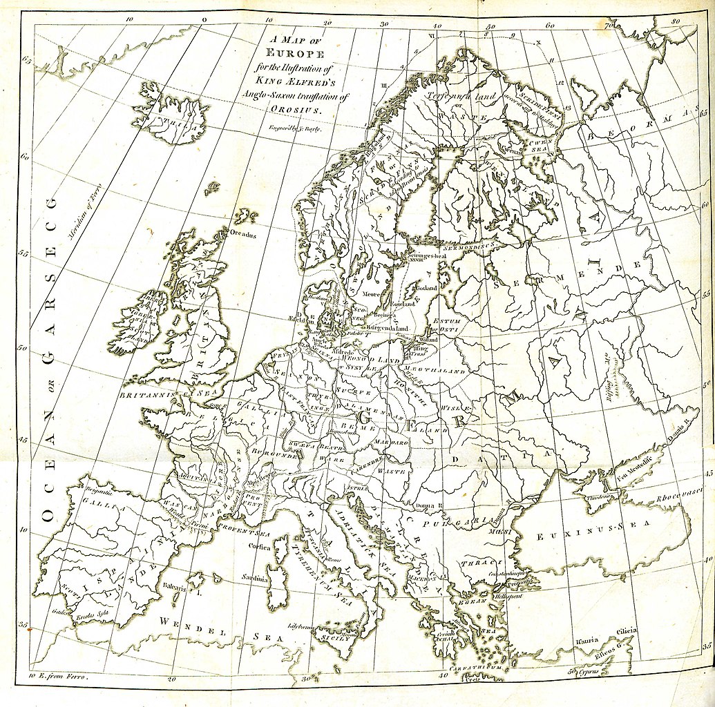
English: Folding engraved map published in: Daines Barrington (ed./transl.), King Ælfred’s Orosius: The Anglo-Saxon Version, from the Historian Orosius. By Ælfred the Great. Together with an English Translation from the Anglo-Saxon. London: printed by W. Bowyer and J. Nichols: and sold by S. Baker and G. Leigh; T. Payne; and B. White, 1773, II, after p. 260. Drawn up by Johann Reinhold Forster and his son Georg Forster (uncredited, see: Johann Reinhold Forster, Geschichte der Entdeckungen und Schiffahrten im Norden. Frankfurt an der Oder: Carl Gottlieb Strauß, 1784, pp. XIII–XIV, and: Walter Goffart, Historical Atlases: The First Three Hundred Years, 1570–1870. Chicago/London: The University of Chicago Press, 2003, pp. 197, 200). Engraved by John Bayly. Description of the map (Barrington, op. cit., I, p. xxiv): |
| Źródło | Daines Barrington (ed./transl.), King Ælfred’s Orosius: The Anglo-Saxon Version, from the Historian Orosius. By Ælfred the Great |
| Autor | Drawn up by Johann Reinhold Forster and his son Georg Forster |
Licencja
|
Ten materiał przeszedł do domeny publicznej w kraju pochodzenia, jak również w państwach i terytoriach, gdzie prawo autorskie wygasa w ciągu 100 lat po śmierci autora. Powyższa praca jest własnością publiczną w Stanach Zjednoczonych, ponieważ została opublikowana (lub zarejestrowana w U.S. Copyright Office) przed 1 stycznia 1929. | |
| Plik rozpoznano jako wolny od znanych ograniczeń praw autorskich, włącznie z prawami zależnymi i pokrewnymi. | |
| Adnotacje | To zdjęcie jest opatrzone adnotacją: Zobacz adnotacje w Commons |
Historia pliku
Kliknij na datę/czas, aby zobaczyć, jak plik wyglądał w tym czasie.
| Data i czas | Miniatura | Wymiary | Użytkownik | Opis | |
|---|---|---|---|---|---|
| aktualny | 13:11, 29 sie 2016 | | 3254 × 3220 (1,97 MB) | BarringtonForster | Engraved folding map published in: Daines Barrington (ed./transl.), ''King Ælfred’s Orosius: The Anglo-Saxon Version, from the Historian Orosius. By Ælfred the Great. Together with an English Translation from the Anglo-Saxon''. London: printed by W... |
Lokalne wykorzystanie pliku
Następujące strony korzystają z tego pliku:
Globalne wykorzystanie pliku
Ten plik jest wykorzystywany także w innych projektach wiki:
- Wykorzystanie na en.wikipedia.org
- Wykorzystanie na lt.wikipedia.org
- Wykorzystanie na pt.wikipedia.org
- Wykorzystanie na sl.wikipedia.org