
Plik:Cambridgeshire UK location map.svg

Wielkość pliku podglądu PNG dla pliku SVG: 533 × 600 pikseli Inne rozdzielczości: 213 × 240 pikseli | 426 × 480 pikseli | 682 × 768 pikseli | 910 × 1024 pikseli | 1820 × 2048 pikseli | 1125 × 1266 pikseli.
Rozmiar pierwotny (Plik SVG, nominalnie 1125 × 1266 pikseli, rozmiar pliku: 1,79 MB)
| Plik Cambridgeshire UK location map.svg znajduje się w Wikimedia Commons – repozytorium wolnych zasobów. Dane z jego strony opisu znajdują się poniżej. |
| Opis |
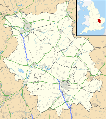
Map of Cambridgeshire, UK with the following information shown:
Equirectangular map projection on WGS 84 datum, with N/S stretched 160% Geographic limits:
|
| Data | |
| Źródło |
|
| Autor | Nilfanion, created using Ordnance Survey data |
| Licencja (Ponowne użycie tego pliku) |
Ten plik udostępniony jest na licencji Creative Commons Uznanie autorstwa – Na tych samych warunkach 3.0. Uznanie autorstwa: Contains Ordnance Survey data © Crown copyright and database right
|
| Inne wersje | File:Cambridgeshire UK district map (blank).svg - Blank map |
.svg)
Historia pliku
Kliknij na datę/czas, aby zobaczyć, jak plik wyglądał w tym czasie.
| Data i czas | Miniatura | Wymiary | Użytkownik | Opis | |
|---|---|---|---|---|---|
| aktualny | 20:41, 26 wrz 2010 | | 1125 × 1266 (1,79 MB) | Nilfanion | {{Information |Description=Map of Cambridgeshire, UK with the following information shown: *Administrative borders *Coastline, lakes and rivers *Roads and railways *Urban areas Equirectangular map projection on WGS 84 datum, with N/S |
Lokalne wykorzystanie pliku
Z tego pliku korzysta więcej niż 100 stron. Poniższa lista pokazuje jedynie 100 pierwszych z nich. Dostępna jest również pełna lista.
- Abbots Ripton
- Abbotsley
- Abington (Cambridgeshire)
- Abington Pigotts
- Ailsworth
- Alconbury
- Alconbury Weston
- Aldreth
- Alwalton
- Arrington
- Ashley (Cambridgeshire)
- Ashton (Cambridgeshire)
- AstraZeneca
- Babraham
- Bainton (Cambridgeshire)
- Balsham
- Bar Hill
- Barham and Woolley
- Barnack
- Barrington (Cambridgeshire)
- Bartlow
- Barton (Cambridgeshire)
- Barway
- Bassingbourn cum Kneesworth
- Benwick
- Bluntisham
- Borough Fen
- Bottisham
- Bourn
- Boxworth
- Brampton (Cambridgeshire)
- Brington (Cambridgeshire)
- Brinkley (Cambridgeshire)
- Broughton (Cambridgeshire)
- Buckden (Cambridgeshire)
- Buckworth
- Burwell (Cambridgeshire)
- Bury (Cambridgeshire)
- Bythorn
- Bythorn and Keyston
- Cambourne
- Cambridge
- Cambridge (stacja kolejowa)
- Cambridgeshire
- Carlton (Cambridgeshire)
- Castle Camps
- Castor (Cambridgeshire)
- Catworth
- Caxton
- Chatteris
- Cherry Hinton
- Chettisham
- Cheveley
- Chippenham (Cambridgeshire)
- Chittering
- Christchurch (Cambridgeshire)
- Coates (Cambridgeshire)
- Coldham (Cambridgeshire)
- Colne (Cambridgeshire)
- Comberton
- Coppingford
- Coton (Cambridgeshire)
- Cottenham
- Coveney
- Covington (Cambridgeshire)
- Croxton (Cambridgeshire)
- Croydon (Cambridgeshire)
- Deeping Gate
- Denton (Cambridgeshire)
- Diddington
- Doddington (Cambridgeshire)
- Dry Drayton
- Dullingham
- Duxford
- Earith
- Easton (Cambridgeshire)
- Eaton Socon
- Ellington (Cambridgeshire)
- Elm (Cambridgeshire)
- Ely
- Ely (stacja kolejowa)
- Fulbourn
- Godmanchester
- Gonville and Caius College
- Huntingdon
- Katedra w Ely
- King’s College (Cambridge)
- Kolegium Trójcy Świętej w Cambridge
- Littleport
- March (Anglia)
- Newnham College
- Peterborough
- Peterborough (stacja kolejowa)
- Peterhouse
- Ramsey (Cambridgeshire)
- Soham
- St Ives (Cambridgeshire)
- St Neots
- Trinity Hall (Cambridge)
- University of Cambridge
Pokaż więcej odnośników do tego pliku.
Globalne wykorzystanie pliku
Ten plik jest wykorzystywany także w innych projektach wiki:
- Wykorzystanie na ar.wikipedia.org
- Wykorzystanie na bg.wikipedia.org
- Wykorzystanie na ceb.wikipedia.org
- Wykorzystanie na en.wikipedia.org
- Peterborough
- Kimbolton Castle
- St Ives, Cambridgeshire
- Littleport
- Ramsey Abbey
- St Neots
- Eye, Cambridgeshire
- Eye Green
- Werrington, Peterborough
- Grantchester
- Wisbech
- Coton, Cambridgeshire
- Flag Fen
- Burwell, Cambridgeshire
- Huntingdon
- Perry, Cambridgeshire
- Gamlingay
- Godmanchester
- Eynesbury, Cambridgeshire
- Eaton Ford
- Eaton Socon
- Kimbolton, Cambridgeshire
- Chesterton, Cambridge
- Cambourne
- Soham
- Duxford
- Ramsey, Cambridgeshire
- Orton, Peterborough
- Whittlesey
- March, Cambridgeshire
- Girton College, Cambridge
- Chatteris
- Caldecote, South Cambridgeshire
- Addenbrooke's Hospital
- The Abingtons, Cambridgeshire
- Meldreth
- Denny Abbey
- Wimpole Estate
- Anglesey Abbey
- Hampton, Peterborough
- Thorpe Hall (Peterborough)
- Isleham
- Witcham
- Fulbourn
- Great Wilbraham
- Little Wilbraham
Pokaż listę globalnego wykorzystania tego pliku.