
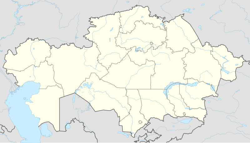
Plik:Kazakhstan adm location map.svg

Rozmiar pierwotny (Plik SVG, nominalnie 1984 × 1134 pikseli, rozmiar pliku: 562 KB)
| Plik Kazakhstan adm location map.svg znajduje się w Wikimedia Commons – repozytorium wolnych zasobów. Dane z jego strony opisu znajdują się poniżej. |
Opis
| Opis |
Deutsch: Positionskarte von Kasachstan
English: Location map of Kazakhstan
|
||||||||||||
| Data | |||||||||||||
| Źródło |
Praca własna przy użyciu:
|
||||||||||||
| Autor | NordNordWest | ||||||||||||
| Inne wersje |
|
||||||||||||
_location_map.svg)

|
Ta mapa została stworzona lub ulepszona w niemieckiej Kartenwerkstatt (Pracowni Kartograficznej). I Ty możesz zaproponować inne mapy do ulepszenia.
|
Licencja
Usage of this file with:

explanatory notes: Legally binding is only the full legalcode. For a free usage I recommend to respect the following licence conditions:
1. Provide my name as given above: NordNordWest,
2. a copy of, or the URI for, the applicable license: https://creativecommons.org/licenses/by-sa/3.0/de/legalcode,
3. the title of the work,
4. in the case of an adaptation, a credit identifying the use of the work in the adaptation.
This license and the rights granted hereunder will terminate automatically upon any breach by you of the terms of this license. Any of the above conditions can be waived if you get permission from the copyright holder. If you have questions or wish differing conditions, please contact me through nnwest or my discussion page ![]() t-online.de
t-online.de
- Wolno:
- dzielić się – kopiować, rozpowszechniać, odtwarzać i wykonywać utwór
- modyfikować – tworzyć utwory zależne
- Na następujących warunkach:
- uznanie autorstwa – musisz określić autorstwo utworu, podać link do licencji, a także wskazać czy utwór został zmieniony. Możesz to zrobić w każdy rozsądny sposób, o ile nie będzie to sugerować, że licencjodawca popiera Ciebie lub Twoje użycie utworu.
- na tych samych warunkach – Jeśli zmienia się lub przekształca niniejszy utwór, lub tworzy inny na jego podstawie, można rozpowszechniać powstały w ten sposób nowy utwór tylko na podstawie tej samej lub podobnej licencji.

Historia pliku
Kliknij na datę/czas, aby zobaczyć, jak plik wyglądał w tym czasie.
| Data i czas | Miniatura | Wymiary | Użytkownik | Opis | |
|---|---|---|---|---|---|
| aktualny | 16:16, 4 paź 2022 | | 1984 × 1134 (562 KB) | NordNordWest | upd 2022 |
| 21:45, 21 lut 2022 |  | 1984 × 1134 (554 KB) | NordNordWest | corr | |
| 23:41, 25 cze 2018 |  | 1984 × 1134 (619 KB) | NordNordWest | corr | |
| 17:48, 26 wrz 2014 |  | 1984 × 1134 (618 KB) | NordNordWest | == {{int:filedesc}} == {{Information |Description= {{de|1=Positionskarte von Kasachstan}} {{en|1=Location map of Kazakhstan}} {{Location map series N |stretching=150 |top=56 |bottom=40 |left=46 |right=88 }} |Source={{Own using}} * United States Nationa... |
Lokalne wykorzystanie pliku
Z tego pliku korzysta więcej niż 100 stron. Poniższa lista pokazuje jedynie 100 pierwszych z nich. Dostępna jest również pełna lista.
- Abaj (miasto w Kazachstanie)
- Ajagöz
- Akköl
- Aksaj (obwód zachodniokazachstański)
- Aksu (obwód pawłodarski)
- Aksu (obwód turkiestański)
- Aktas
- Aktobe
- Aralsk
- Arkałyk
- Arys (miasto)
- Atbasar
- Ałtaj (miasto)
- Bajkonur
- Bajkonur (miasto)
- Bałchasz (miasto)
- Bałykszy
- Borałdaj
- Chromtau
- Czu
- Farab
- Fort-Szewczenko
- Jekybastuz
- Jemby
- Jesyk
- Kandyagasz
- Karabułak (Kazachstan)
- Karaganda
- Karatau (miasto)
- Kargały
- Kaskeleng
- Kazachstan
- Kazały
- Kazykurt
- Kentau
- Kokczetaw
- Konajew
- Kordaj
- Kustanaj
- Kułsary
- Kyzyłorda
- Lenger
- Lisakowsk
- Lista państw świata
- Makinsk
- Manggystau
- Merke
- Pawłodar
- Pietropawłowsk (Kazachstan)
- Port lotniczy Nur-Sułtan
- Puchar Intertoto UEFA (2007)
- Ridder
- Rudnyj
- Saran (Kazachstan)
- Sarkan
- Saryagasz
- Sarykemer
- Saryszagan
- Semej
- Stadion Centralny w Aktobe
- Stadion Centralny w Pawłodarze
- Stiepnogorsk
- Szachtinsk
- Szardara
- Szałkar
- Szczuczyńsk
- Szemonaicha
- Sziely
- Szonży
- Szu (miasto)
- Szymkent
- Sätbajew
- Tamgały
- Taraz
- Tasböget
- Tałas (rzeka)
- Tałdykorgan
- Tałgar
- Tekely
- Temyrtau
- Tobył
- Turar Ryskułow
- Turkiestan (miasto)
- Töle Bi
- Uralsk
- Ust-Kamienogorsk
- Uzynagasz
- Zajsan
- Äjteke Bi
- Ötegen batyr
- Üszarał
- Üsztöbe
- Żangakorgan
- Żangaszar
- Żangatas
- Żangaözen
- Żarkent
- Żetysaj
- Żezkazgan
- Żosały
Pokaż więcej odnośników do tego pliku.
Globalne wykorzystanie pliku
Ten plik jest wykorzystywany także w innych projektach wiki:
- Wykorzystanie na af.wikipedia.org
- Wykorzystanie na an.wikipedia.org
- Wykorzystanie na ar.wikipedia.org
- Wykorzystanie na ast.wikipedia.org
- Wykorzystanie na azb.wikipedia.org
- Wykorzystanie na az.wikipedia.org
Pokaż listę globalnego wykorzystania tego pliku.