
Plik:Land given up to Silesian dukes (Dr. T. Szulc).jpg

Rozmiar pierwotny (1266 × 779 pikseli, rozmiar pliku: 218 KB, typ MIME: image/jpeg)
| Plik Land given up to Silesian dukes (Dr. T. Szulc).jpg znajduje się w Wikimedia Commons – repozytorium wolnych zasobów. Dane z jego strony opisu znajdują się poniżej. |
.jpg)
| Opis |
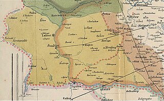
English: Part of a historical map of Greater Poland (Middle Ages) made by Dr. T. Szulc and included in the 4th volume of Codex diplomaticus Maioris Poloniae, covering a Lubusz Land and land given up to Silesian dukes by the Greatpoland dukes Polski: Fragment historycznej mapy Wielkopolski w epoce piastowskiej wykonanej przez Dr. T. Szulca i zamieszczonej w czwartym tomie Kodeksu dyplomatycznego Wielkopolski, obrazujący Ziemię Lubuską (granice diecezji lubuskiej) oraz obszar odstąpiony książętom śląskim przez książąt wielkopolskich |
| Data | (UTC) |
| Źródło | |
| Autor |
|
| To zdjęcie było poddane obróbce cyfrowej i może różnić się od wersji oryginalnej. Zmiany: Extracting part of the map to cover Lubusz Land. Oryginał można obejrzeć tu: WielkoPolska epoki Piastowskiej.jpg:
|
|
Ten materiał przeszedł do domeny publicznej w kraju pochodzenia, jak również w państwach i terytoriach, gdzie prawo autorskie wygasa w ciągu 70 lat po śmierci autora.
| |
| Plik rozpoznano jako wolny od znanych ograniczeń praw autorskich, włącznie z prawami zależnymi i pokrewnymi. | |
Oryginalny rejestr przesyłania
This image is a derivative work of the following images:
- File:WielkoPolska_epoki_Piastowskiej.jpg licensed with PD-old
- 2009-06-22T15:28:59Z Paelius 4075x3613 (10969409 Bytes) {{Information |Description={{en|1=Historical map of Greater Poland (Middle Ages) made by Dr. T. Szulc and included in the 4th volume of Codex diplomaticus Maioris Poloniae}} {{pl|1=Historyczna mapa Wielkopolski w epoce piasto
Uploaded with derivativeFX
Historia pliku
Kliknij na datę/czas, aby zobaczyć, jak plik wyglądał w tym czasie.
| Data i czas | Miniatura | Wymiary | Użytkownik | Opis | |
|---|---|---|---|---|---|
| aktualny | 14:32, 14 sty 2022 | | 1266 × 779 (218 KB) | Davey2010 | rv vandal - please seek consensus for your changes |
| 21:13, 13 sty 2022 |  | 1023 × 1056 (362 KB) | LechitaPL | Reverted to version as of 20:25, 19 September 2021 (UTC) (vandalized) | |
| 03:23, 13 sty 2022 |  | 1266 × 779 (218 KB) | Davey2010 | Reverted to version as of 12:21, 19 August 2009 (UTC) | |
| 22:25, 19 wrz 2021 |  | 1023 × 1056 (362 KB) | LechitaPL | Zmiany | |
| 14:21, 19 sie 2009 |  | 1266 × 779 (218 KB) | Opole.pl | {{Information |Description={{en|1=Part of a historical map of Greater Poland (Middle Ages) made by Dr. T. Szulc and included in the 4th volume of Codex diplomaticus Maioris Poloniae, covering Lubusz Land}} {{pl|1=Fragment historycznej mapy Wielkopolski w |
Lokalne wykorzystanie pliku
Żadna strona nie korzysta z tego pliku.
Globalne wykorzystanie pliku
Ten plik jest wykorzystywany także w innych projektach wiki:
- Wykorzystanie na ar.wikipedia.org
- Wykorzystanie na fr.wikipedia.org
- Wykorzystanie na ru.wikipedia.org
.jpg)