
Plik:Levant 01.PNG
Rozmiar pierwotny (707 × 839 pikseli, rozmiar pliku: 82 KB, typ MIME: image/png)
| Plik Levant 01.PNG znajduje się w Wikimedia Commons – repozytorium wolnych zasobów. Dane z jego strony opisu znajdują się poniżej. |

|
Ta ilustracja ma także wersję wektorową („SVG”).
Zaleca się wykorzystywanie w galeriach dostępnej wersji wektorowej zamiast obecnej. File:Levant 01.PNG → File:Kingdoms of Israel and Judah map 830.svg
Więcej o grafice wektorowej przeczytasz w artykule Przenoszenie grafik Commons do formatu SVG. Dostępna jest także informacja o obsłudze grafik SVG przez MediaWiki. |
 |

|
This map has been uploaded by Electionworld from en.wikipedia.org to enable the |
Opis
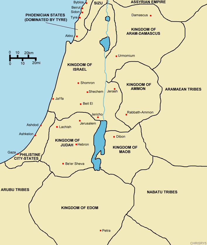
Created by ChrisRy5 using Macromedia Flash. City locations found on Wikipedia.
Map showing the ancient levant borders and ancient cities such as Urmomium and Jerash. The map also shows the region in the 9th century BCE. Notice the coastal land of Philistia, from which the name "Palestine" derives.
Correction: The kingdom to the east of the Dead Sea should be labeled the Kingdom of Moab.
Licencja
| Ten utwór został udostępniony jako własność publiczna przez jego autora, ChrisRy5. Dotyczy to całego świata. W niektórych krajach może nie być to prawnie możliwe, jeśli tak, to: |
Historia pliku
Kliknij na datę/czas, aby zobaczyć, jak plik wyglądał w tym czasie.
| Data i czas | Miniatura | Wymiary | Użytkownik | Opis | |
|---|---|---|---|---|---|
| aktualny | 16:53, 18 gru 2006 | | 707 × 839 (82 KB) | Electionworld | {{ew|en|ChrisRy5}} == Summary == Created by ChrisRy5 using Macromedia Flash. City locations found on Wikipedia.<BR>Map showing the ancient levant borders and ancient cities such as Urmomium and Jerash. The map also shows the region in the 9th cent |
Lokalne wykorzystanie pliku
Następujące strony korzystają z tego pliku:
Globalne wykorzystanie pliku
Ten plik jest wykorzystywany także w innych projektach wiki:
- Wykorzystanie na en.wikipedia.org
- Wykorzystanie na he.wikipedia.org
- Wykorzystanie na id.wikipedia.org
- Wykorzystanie na ms.wikipedia.org
- Wykorzystanie na sq.wikipedia.org