
Plik:NPS olympic-regional-map.jpg

Rozmiar podglądu – 743 × 600 pikseli. Inne rozdzielczości: 298 × 240 pikseli | 595 × 480 pikseli | 1000 × 807 pikseli.
Rozmiar pierwotny (1000 × 807 pikseli, rozmiar pliku: 223 KB, typ MIME: image/jpeg)
| Plik NPS olympic-regional-map.jpg znajduje się w Wikimedia Commons – repozytorium wolnych zasobów. Dane z jego strony opisu znajdują się poniżej. |
Opis
| Opis |
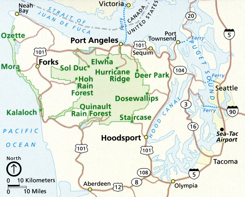
English: This Olympic regional map shows the surrounding roads and communities and can help you plan your trip logistics as you arrive from Seattle or another major town. |
| Data | |
| Źródło | U.S. National Park Service (http://npmaps.com/wp-content/uploads/olympic-regional-map.jpg) |
| Autor | U.S. National Park Service, restoration/cleanup by Matt Holly |
Licencja
| This image or media file contains material based on a work of a National Park Service employee, created as part of that person's official duties. As a work of the U.S. federal government, such work is in the public domain in the United States. See the NPS website and NPS copyright policy for more information. |
Historia pliku
Kliknij na datę/czas, aby zobaczyć, jak plik wyglądał w tym czasie.
| Data i czas | Miniatura | Wymiary | Użytkownik | Opis | |
|---|---|---|---|---|---|
| aktualny | 03:37, 17 maj 2017 | | 1000 × 807 (223 KB) | RKBot | =={{int:filedesc}}== {{Information |description= {{en|1=This Olympic regional map shows the surrounding roads and communities and can help you plan your trip logistics as you arrive from Seattle or another major town.}} |date= 2013-11-01 |source= U.S.... |
Lokalne wykorzystanie pliku
Poniższa strona korzysta z tego pliku: