
Plik:NepalBaglungDistrictmap.png

Rozmiar pierwotny (3508 × 2479 pikseli, rozmiar pliku: 379 KB, typ MIME: image/png)
| Plik NepalBaglungDistrictmap.png znajduje się w Wikimedia Commons – repozytorium wolnych zasobów. Dane z jego strony opisu znajdują się poniżej. |
| Opis |
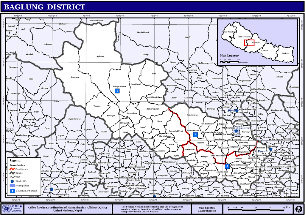
English: Map displaying Village Development Committees in Baglung District, Nepal |
|||
| Data | ||||
| Źródło | http://www.un.org.np/maps/district-maps/western/Baglung.pdf | |||
| Autor | United Nations | |||
| Licencja (Ponowne użycie tego pliku) |
|

Historia pliku
Kliknij na datę/czas, aby zobaczyć, jak plik wyglądał w tym czasie.
| Data i czas | Miniatura | Wymiary | Użytkownik | Opis | |
|---|---|---|---|---|---|
| aktualny | 03:34, 6 lis 2008 | | 3508 × 2479 (379 KB) | Sadalmelik | {{Information |Description={{en|1=Map displaying Village Development Committees in Baglung District, Nepal}} |Source=http://www.un.org.np/maps/district-maps/western/Baglung.pdf |Date=March 4, 2008 |Author=United Nations |Permission={{PD-UN}} |other_ve |
Lokalne wykorzystanie pliku
Poniższa strona korzysta z tego pliku:
Globalne wykorzystanie pliku
Ten plik jest wykorzystywany także w innych projektach wiki:
- Wykorzystanie na bpy.wikipedia.org
- Wykorzystanie na de.wikipedia.org
- Wykorzystanie na en.wikipedia.org
- Wykorzystanie na fi.wikipedia.org
- Wykorzystanie na mai.wikipedia.org
- आकृति:बागलुङ जिलाक गाविस तथा नगरपालिकासभ
- अधिकारीचौर
- अर्गल
- अर्जेवा
- अमरभुमी
- अमलाचौर
- काँडेवास
- कुस्मीशेरा
- खुङखानी
- खुंगा
- ग्वालीचौर
- छिस्ती
- जलजला, बागलुङ
- जैदी
- तमान
- तारा गाविस
- तित्याङ
- दगातुन्डाँडा
- दमेक
- दर्लिङ
- दुदिलाभाटी
- देविस्थान, बागलुङ
- धम्जा
- धुल्लुवास्कोट
- नरेठाँटी
- नारायणस्थान, बागलुङ
- निसी
- पाला
- पाण्डवखानी
- पैयुँपाटा
- पैयुँथन्थाप
- बाटाकाचौर
- बिहुँकोट
- बिनामारे
- बुर्तिबाङ
- बुंगादोभान
- बोहरागाउँ
- बोवाङ
- हुग्दीशिर
- हिल
- हरीचौर
- हटिया, बागलुङ
- भकुण्डे
- भिमपोखरा
- भिमगिठे
Pokaż listę globalnego wykorzystania tego pliku.