
Plik:PEFO park map 2006 large.png
Rozmiar podglądu – 485 × 600 pikseli. Inne rozdzielczości: 194 × 240 pikseli | 388 × 480 pikseli | 621 × 768 pikseli | 828 × 1024 pikseli | 1800 × 2225 pikseli.
Rozmiar pierwotny (1800 × 2225 pikseli, rozmiar pliku: 1,69 MB, typ MIME: image/png)
| Plik PEFO park map 2006 large.png znajduje się w Wikimedia Commons – repozytorium wolnych zasobów. Dane z jego strony opisu znajdują się poniżej. |
Opis
| Opis |
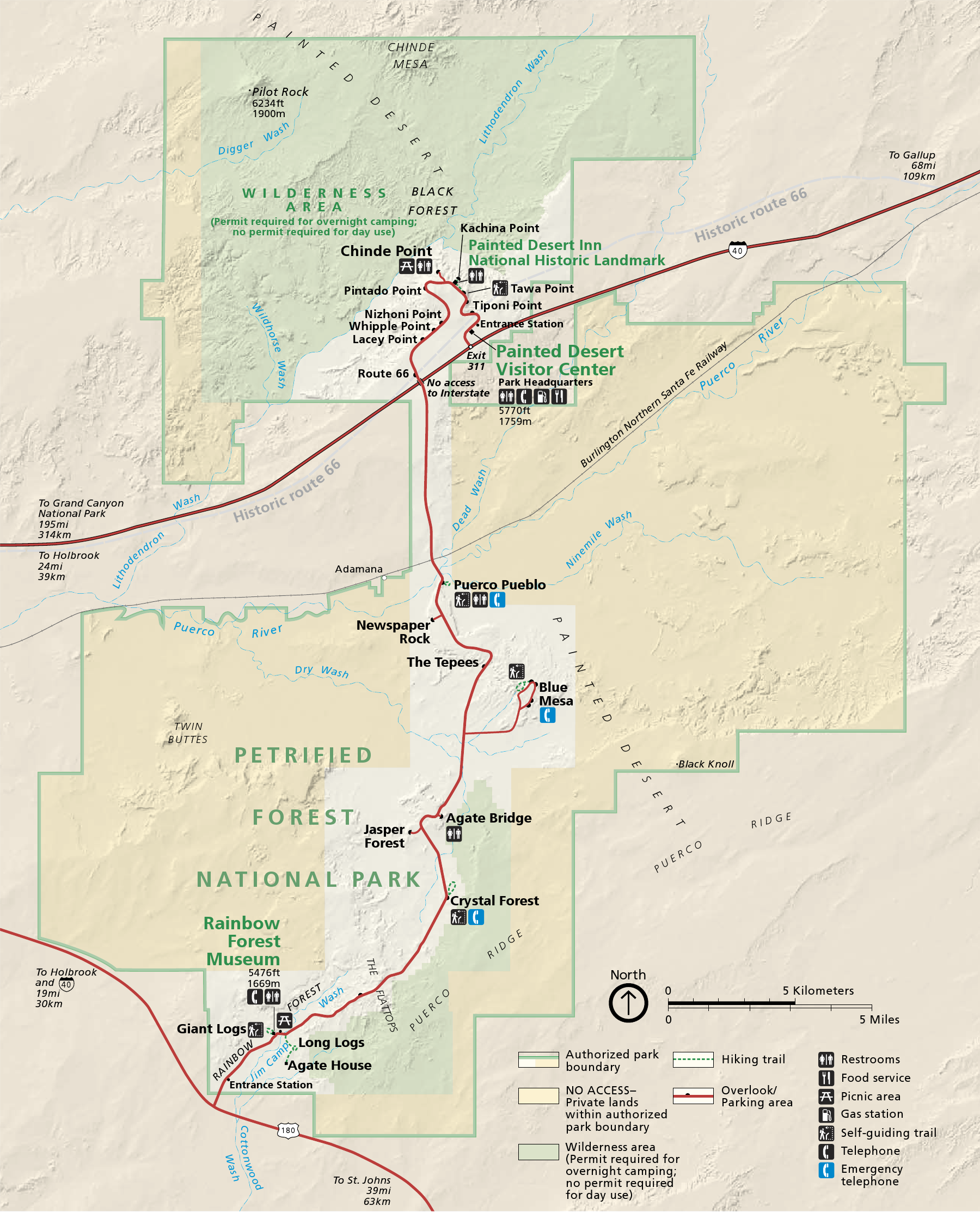
English: Map of Petrified Forest National Park — in northeastern Arizona, United States.
|
| Data | |
| Źródło | official park map |
| Autor | National Park Service; converted from PDF to PNG format by User:Finetooth using GNU Image Manipulation Program (GIMP) software |
Licencja
| This image or media file contains material based on a work of a National Park Service employee, created as part of that person's official duties. As a work of the U.S. federal government, such work is in the public domain in the United States. See the NPS website and NPS copyright policy for more information. |
Historia pliku
Kliknij na datę/czas, aby zobaczyć, jak plik wyglądał w tym czasie.
| Data i czas | Miniatura | Wymiary | Użytkownik | Opis | |
|---|---|---|---|---|---|
| aktualny | 22:41, 28 paź 2010 | | 1800 × 2225 (1,69 MB) | Finetooth | {{Information |Description={{en|1=Map of Petrified Forest National Park in northeastern Arizona, United States}} |Source=National Park Service [http://www.nps.gov/pefo/planyourvisit/maps.htm maps] |Au |
Lokalne wykorzystanie pliku
Poniższa strona korzysta z tego pliku:
Globalne wykorzystanie pliku
Ten plik jest wykorzystywany także w innych projektach wiki:
- Wykorzystanie na da.wikipedia.org
- Wykorzystanie na de.wikipedia.org
- Wykorzystanie na en.wikipedia.org
- Wykorzystanie na eu.wikipedia.org
- Wykorzystanie na he.wikipedia.org
- Wykorzystanie na nl.wikipedia.org
- Wykorzystanie na pt.wikipedia.org
- Wykorzystanie na tr.wikipedia.org
- Wykorzystanie na vi.wikipedia.org