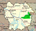
Plik:Un-mali Kayes Region.png

Treść strony nie jest dostępna w innych językach.
Ten plik jest umieszczony w Wikimedia Commons
Z Wikipedii, wolnej encyklopedii

Un-mali_Kayes_Region.png(692 × 594 pikseli, rozmiar pliku: 208 KB, typ MIME: image/png)

Opis

Opis Map of the Kayes Region of Mali. Additions include new northern road via Diema, several towns, downgrade of road (in fact unpaved) from Kayes to Kenieba. Solid pink lines are paved, dashed are unpaved. Addition of National park of Boucle du Baoule. Ref: Ross Velton. Mali. Bradt UK and Globe Pequot US (2005/2006) ISBN 9781841620770 Made with GIMP
Data
Źródło self-made, edit, crop, recolored, several additions to Image:Un-mali.png from http://www.un.org/Depts/Cartographic/english/htmain.htm
Autor T L Miles
Licencja
(Ponowne użycie tego pliku)

Modified versions of UNCS maps may be used provided that the UN name and reference number does not appear on any modified version and a link to the original map is provided. Modified UN maps are to be considered in the public domain. This applies worldwide SEE:

Public domain This image is a map derived from a United Nations map.

Unless stated otherwise, UN maps are to be considered in the public domain. This applies worldwide.
Some UN maps have special copyrights, as indicated on the map itself.

UN maps are, in principle, open source material and you can use them in your work or for making your own map. UN requests however that you delete the UN name, logo and reference number upon any modification to the map. Content of your map will be your responsibility. You can state in your publication, if you wish, something like: based on UN map … (map name, map number, revision number and date). See: Geospatial Information Section. And: Geospatial, location data for a better world.

Inne wersje Image:Un-mali.png

Licencja

Public domain Ja, właściciel praw autorskich do tej pracy, udostępniam ją jako własność publiczną. Dotyczy to całego świata.
W niektórych krajach może nie być to prawnie możliwe, jeśli tak, to:
Zapewniam każdemu prawo do użycia tej pracy w dowolnym celu, bez żadnych ograniczeń, chyba że te ograniczenia są wymagane przez prawo.

Podpisy

Dodaj jednolinijkowe objaśnienie tego, co ten plik pokazuje

Obiekty przedstawione na tym zdjęciu

przedstawia

Historia pliku

Kliknij na datę/czas, aby zobaczyć, jak plik wyglądał w tym czasie.

Data i czasMiniaturaWymiaryUżytkownikOpis
aktualny20:42, 4 mar 2008Miniatura wersji z 20:42, 4 mar 2008692 × 594 (208 KB)T L Miles{{Information |Description=Map of the Kayes Region of Mali. Additions include new northern road via Diema, several towns, downgrade of road (in fact unpaved) from Kayes to Kenieba. Solid pink lines are paved, dashed are unpaved. Addition of National pa

Poniższa strona korzysta z tego pliku:

Globalne wykorzystanie pliku

Ten plik jest wykorzystywany także w innych projektach wiki: