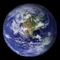
Plik:Earth Western Hemisphere.tif
Treść strony nie jest dostępna w innych językach.
Wygląd

Wielkość pliku podglądu JPG dla pliku TIF: 600 × 600 pikseli Inne rozdzielczości: 240 × 240 pikseli | 480 × 480 pikseli | 768 × 768 pikseli | 1024 × 1024 pikseli | 2048 × 2048 pikseli.
Rozmiar pierwotny (2048 × 2048 pikseli, rozmiar pliku: 9,91 MB, typ MIME: image/tiff)
| Plik Earth Western Hemisphere.tif znajduje się w Wikimedia Commons – repozytorium wolnych zasobów. Dane z jego strony opisu znajdują się poniżej. |

|
Ten plik został zastąpiony przez File:Earth Western Hemisphere 2002.png. Sugerujemy użycie tamtego pliku.
|

|
Opis
| OpisEarth Western Hemisphere.tif |
English: Original file from NASA. Strangely structured, does not display correctly here. Use the PNG instead.
“Blue Marble”. Original caption:
|
| Data | |
| Źródło | https://visibleearth.nasa.gov/view.php?id=57723 |
| Autor |
|
| Inne wersje |
Licencja
| Public domainPublic domainfalsefalse |
| Ten plik jest w domenie publicznej ponieważ został stworzony przez NASA. Polityka praw autorskich NASA stwierdza, że „materiały NASA nie są chronione prawami autorskimi, chyba że zapisano inaczej”. (NASA copyright policy lub JPL Image Use Policy). |  | |
 |
Uwaga:
|
Podpisy
Dodaj jednolinijkowe objaśnienie tego, co ten plik pokazuje
Obiekty przedstawione na tym zdjęciu
przedstawia
8 lut 2002
Historia pliku
Kliknij na datę/czas, aby zobaczyć, jak plik wyglądał w tym czasie.
| Data i czas | Miniatura | Wymiary | Użytkownik | Opis | |
|---|---|---|---|---|---|
| aktualny | 18:11, 16 kwi 2018 |  | 2048 × 2048 (9,91 MB) | Alexis Jazz | User created page with UploadWizard |
Lokalne wykorzystanie pliku
Żadna strona nie korzysta z tego pliku.
Metadane
Niniejszy plik zawiera dodatkowe informacje, prawdopodobnie dodane przez aparat cyfrowy lub skaner użyte do wygenerowania tego pliku.
Jeśli plik był modyfikowany, dane mogą być częściowo niezgodne z parametrami zmodyfikowanego pliku.
| Szerokość | 2048 px |
|---|---|
| Wysokość | 2048 px |
| Metoda kompresji | LZW |
| Interpretacja fotometryczna | RGB |
| Próbek na piksel | 7 |
| Liczba wierszy na pas obrazu | 1 |
| Rozdzielczość w poziomie | 72 punktów na cal |
| Rozdzielczość w pionie | 72 punktów na cal |
| Rozkład danych | format masywny |


