Plik:Breisgau zur Zeit der Karolinger Karte in "Badische Landes-Geschichte" v. Josef Bader, 1836.jpg

Treść strony nie jest dostępna w innych językach.
Ten plik jest umieszczony w Wikimedia Commons
Z Wikipedii, wolnej encyklopedii

Rozmiar pierwotny(1536 × 2048 pikseli, rozmiar pliku: 1,5 MB, typ MIME: image/jpeg)

Opis

Opis
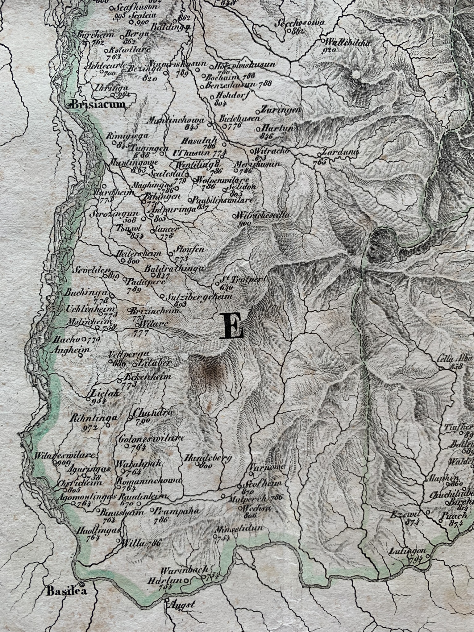
English: The SW part of the region of Breisgau in the times of the Carolingian dynasty; numbers beside names of places are years of the first documented mention of a given place.
Data lub 1896
Źródło "Badische Landes-Geschichte" (published 1834) von Joseph Bader (1805–1883)
Autor DaLoetz
Licencja
(Ponowne użycie tego pliku)
Public domain

Ten materiał przeszedł do domeny publicznej w kraju pochodzenia, jak również w państwach i terytoriach, gdzie prawo autorskie wygasa w ciągu 70 lat po śmierci autora.


You must also include a United States public domain tag to indicate why this work is in the public domain in the United States. Note that a few countries have copyright terms longer than 70 years: Mexico has 100 years, Jamaica has 95 years, Colombia has 80 years, and Guatemala and Samoa have 75 years. This image may not be in the public domain in these countries, which moreover do not implement the rule of the shorter term. Honduras has a general copyright term of 75 years, but it does implement the rule of the shorter term. Copyright may extend on works created by French who died for France in World War II (more information), Russians who served in the Eastern Front of World War II (known as the Great Patriotic War in Russia) and posthumously rehabilitated victims of Soviet repressions (more information).

Pozycja fotografa47° 55′ 15,72″ N, 7° 47′ 02,65″ E  Heading=98.695480365522° Kartographer map based on OpenStreetMap.To i inne zdjęcia na: OpenStreetMapinfo

Podpisy

Dodaj jednolinijkowe objaśnienie tego, co ten plik pokazuje
Breisgau on an excerpt from a map in "Badische Landes-Geschichte" by Josef Bader, publ. 1836.

Obiekty przedstawione na tym zdjęciu

przedstawia

Jakaś wartość bez elementu Wikidanych

autor: Joseph Bader angielski
Reference
Reference
tytuł: Badische Landes-Geschichte von den ältesten bis auf unsere Zeiten (niemiecki)

Brak wartości tej właściwości

47°55'15.719"N, 7°47'2.648"E

kierunek (fotografia): 98,69548036552236 stopień

0,00826446280991735537 sekunda

4,25 milimetr

image/jpeg

9dafebf741a8d5a454256fc9d189184aeab1ca96

1 572 569 bajt

2048 piksel

1536 piksel

Historia pliku

Kliknij na datę/czas, aby zobaczyć, jak plik wyglądał w tym czasie.

Data i czasMiniaturaWymiaryUżytkownikOpis
aktualny16:04, 7 sie 2022Miniatura wersji z 16:04, 7 sie 20221536 × 2048 (1,5 MB)DaLoetzUploaded own work with UploadWizard

Poniższa strona korzysta z tego pliku:

Metadane