
Plik:Harta - mapa z 1779-1783.jpg
Rozmiar pierwotny (2240 × 1600 pikseli, rozmiar pliku: 2,2 MB, typ MIME: image/jpeg)
| Plik Harta - mapa z 1779-1783.jpg znajduje się w Wikimedia Commons – repozytorium wolnych zasobów. Dane z jego strony opisu znajdują się poniżej. |
Opis
| Opis |
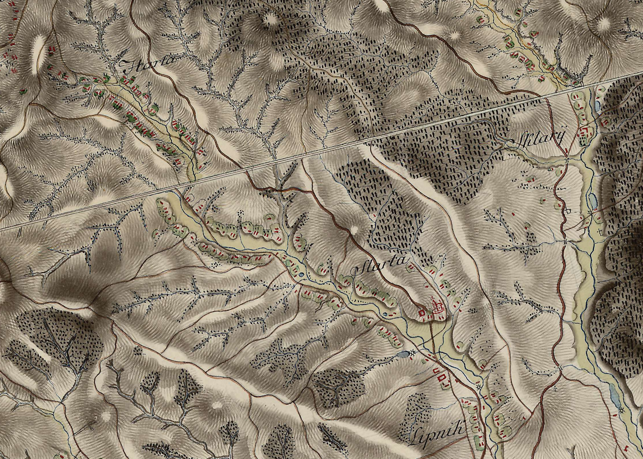
Polski: Wycinek topograficznej mapy józefińskiej Królestwa Galicji i Lodomerii z lat 1779-1783, przedstawiający wieś Harta. |
| Data | między 1779 a 1783 |
| Źródło | Österreichisches Staatsarchiv |
| Autor | Friedrich von Mieg |
Licencja
| The copyright to this Austrian simple photographic picture ("Lichtbild") has expired and it is currently in the public domain in Austria pursuant to the provisions of Article 74(6) of Federal Law BGBI No. 111 of 1936 in the Version of 2003-07-01 (details).
For a simple photograph ("Lichtbild"), such as simple passport photos from Photo booths, photos from satellites, pictures from radiography, it was either published more than 50 years ago or it was taken more than 50 years ago and never published within 50 years of its creation. Photographs that involve artistic interpretations, such as studio shots and those that involve lighting and poses, qualify as photographic works ("Lichtbildwerke") or "works of literature, music and art" (Eurobike: OGH, Beschluss vom 12.9.2001, 4 Ob 179/01d and Article 60). As such, a 70-year p.m.a. term of protection is applied (see this discussion). In order to be acceptable on Commons, works must be in the public domain in the United States as well as in their source country. Austrian works are currently in the public domain in the United States if their copyright had expired in Austria on the U.S. date of restoration (January 1, 1996). However, some works might have a subsisting U.S. copyright resulting from the long-standing copyright relations between Austria and the United States.
|

|
Historia pliku
Kliknij na datę/czas, aby zobaczyć, jak plik wyglądał w tym czasie.
| Data i czas | Miniatura | Wymiary | Użytkownik | Opis | |
|---|---|---|---|---|---|
| aktualny | 20:59, 23 maj 2023 | | 2240 × 1600 (2,2 MB) | TexLacerta | == {{int:filedesc}} == {{Information |description={{pl|1=Wycinek topograficznej mapy józefińskiej Królestwa Galicji i Lodomerii z lat 1779-1783, przedstawiający wieś Harta.}} |date=1779-1783 |source=[https://maps.arcanum.com/en/map/europe-18century-firstsurvey/?layers=163%2C165&bbox=2461899.6707302975%2C6418499.614027107%2C2481887.953626871%2C6427977.805534469 Österreichisches Staatsarchiv] |author=Friedrich von Mieg |permission= |other versions= }} =={{int:license-header}}== {{PD-Austria}}... |
Lokalne wykorzystanie pliku
Poniższa strona korzysta z tego pliku:
Globalne wykorzystanie pliku
Ten plik jest wykorzystywany także w innych projektach wiki:
- Wykorzystanie na vi.wikipedia.org