
Plik:Interstate Highway plan September 1955.jpg

Rozmiar pierwotny (1799 × 1268 pikseli, rozmiar pliku: 123 KB, typ MIME: image/jpeg)
| Plik Interstate Highway plan September 1955.jpg znajduje się w Wikimedia Commons – repozytorium wolnych zasobów. Dane z jego strony opisu znajdują się poniżej. |
| Opis | ||||
| Data | ||||
| Źródło |
|
|||
| Autor | Public Roads Administration - Federal Works Agency (predecessor to the United States Department of Transportation). | |||
| Licencja (Ponowne użycie tego pliku) |
|


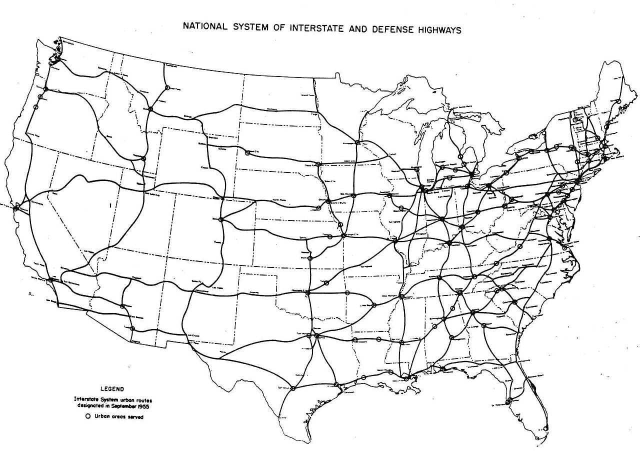
| Interstate Highway System planning maps | ||
|---|---|---|
| August 2, 1947 map 1 - map 2 |
September 1955 | August 14, 1957 |
Historia pliku
Kliknij na datę/czas, aby zobaczyć, jak plik wyglądał w tym czasie.
| Data i czas | Miniatura | Wymiary | Użytkownik | Opis | |
|---|---|---|---|---|---|
| aktualny | 07:54, 25 gru 2005 | | 1799 × 1268 (123 KB) | SPUI~commonswiki | {{PD-USGov}} October 1957 map of the Interstate Highway System, from [http://www.kurumi.com/roads/3di/pics/map-isr-sep55.jpg]. Map 19571000 Category:road maps |
Lokalne wykorzystanie pliku
Poniższa strona korzysta z tego pliku:
Globalne wykorzystanie pliku
Ten plik jest wykorzystywany także w innych projektach wiki:
- Wykorzystanie na en.wikipedia.org
- Wykorzystanie na fr.wikipedia.org
- Wykorzystanie na pt.wikipedia.org
- Wykorzystanie na vi.wikipedia.org