
Plik:Kent UK location map.svg

Wielkość pliku podglądu PNG dla pliku SVG: 800 × 561 pikseli Inne rozdzielczości: 320 × 225 pikseli | 640 × 449 pikseli | 1024 × 719 pikseli | 1280 × 898 pikseli | 2560 × 1796 pikseli | 1425 × 1000 pikseli.
Rozmiar pierwotny (Plik SVG, nominalnie 1425 × 1000 pikseli, rozmiar pliku: 2,11 MB)
| Plik Kent UK location map.svg znajduje się w Wikimedia Commons – repozytorium wolnych zasobów. Dane z jego strony opisu znajdują się poniżej. |
| Opis |
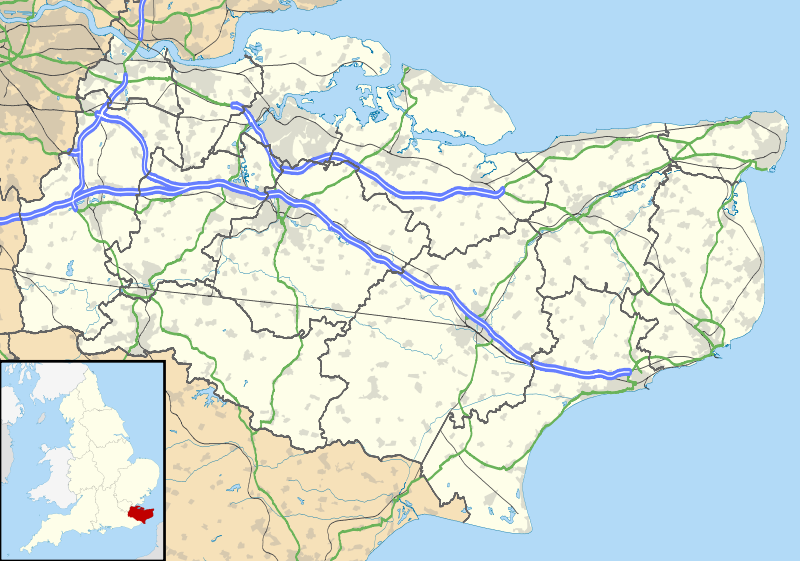
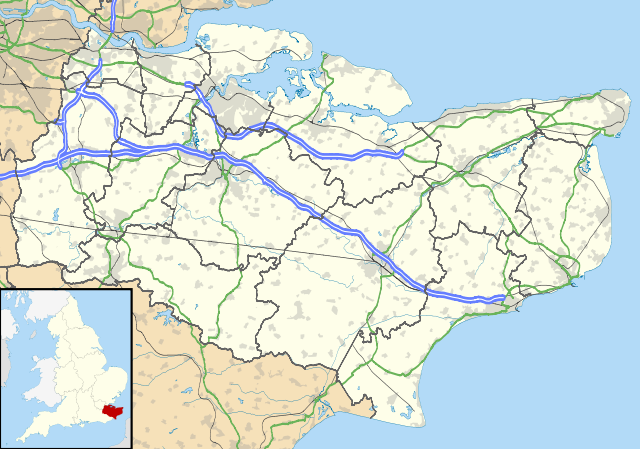
Map of Kent, UK with the following information shown:
Equirectangular map projection on WGS 84 datum, with N/S stretched 160% Geographic limits:
|
| Data | |
| Źródło |
|
| Autor | Nilfanion, created using Ordnance Survey data |
| Licencja (Ponowne użycie tego pliku) |
Ten plik udostępniony jest na licencji Creative Commons Uznanie autorstwa – Na tych samych warunkach 3.0. Uznanie autorstwa: Contains Ordnance Survey data © Crown copyright and database right
|
| Inne wersje | File:Kent UK district map (blank).svg - Blank map |
.svg)
Historia pliku
Kliknij na datę/czas, aby zobaczyć, jak plik wyglądał w tym czasie.
| Data i czas | Miniatura | Wymiary | Użytkownik | Opis | |
|---|---|---|---|---|---|
| aktualny | 20:58, 26 wrz 2010 | | 1425 × 1000 (2,11 MB) | Nilfanion | {{Information |Description=Map of Kent, UK with the following information shown: *Administrative borders *Coastline, lakes and rivers *Roads and railways *Urban areas Equirectangular map projection on WGS 84 datum, with N/S stretched 160% Geo |
Lokalne wykorzystanie pliku
Z tego pliku korzysta więcej niż 100 stron. Poniższa lista pokazuje jedynie 100 pierwszych z nich. Dostępna jest również pełna lista.
- Abbey Gate (Kent)
- Acrise
- Addington (Kent)
- Adisham
- Aldington (Kent)
- Aldington Frith
- Alkham
- Allhallows (Kent)
- Allington (Kent)
- Anvil Green
- Appledore (Kent)
- Arpinge
- Ashford (Kent)
- Ashford International
- Ashley (Kent)
- Ashurst (Kent)
- Aylesford
- Aylesham
- Badgers Mount
- Badlesmere
- Bapchild
- Barham (Kent)
- Barming Heath
- Barnsole
- Barrow Green
- Barrowhill
- Bay View (Kent)
- Bean
- Bearsted
- Bedgebury Cross
- Bedmonton
- Bekesbourne
- Beltinge
- Beltring
- Benenden
- Benover
- Bethersden
- Betsham
- Birchington-on-Sea
- Bishopsbourne
- Broadstairs
- Broadstairs (stacja kolejowa)
- Canterbury
- Canterbury East
- Canterbury West
- Chatham (Anglia)
- Conyer
- Cranbrook (Kent)
- Dartford
- Deal (Wielka Brytania)
- Dover
- Dover Priory
- Edenbridge (Anglia)
- Faversham
- Folkestone
- Folkestone Central
- Fordwich
- Gillingham
- Goudhurst
- Gravesend
- Greenhill (Kent)
- Herne Bay
- Hythe (Kent)
- Katedra Kanterberyjska
- Kent
- Lydd
- Maidstone
- Margate (Wielka Brytania)
- Margate (stacja kolejowa)
- Minster (Swale)
- New Romney
- Northfleet
- Paddock Wood
- Port lotniczy Kent International
- Preston by Wingham
- Queen Elizabeth II Bridge
- Queenborough
- Rainham (Kent)
- Ramsgate
- Ramsgate (stacja kolejowa)
- Rochester (Kent)
- Royal Tunbridge Wells
- Sandwich (Wielka Brytania)
- Sevenoaks
- Sheerness
- Sittingbourne
- Snodland
- Southborough (Kent)
- Stansted (Kent)
- Strood
- Swanley
- Tenterden
- Tonbridge
- Tunbridge Wells (stacja kolejowa)
- Walmer
- West Malling
- Westerham (Wielka Brytania)
- Westgate-on-Sea
- Westmarsh
- Whitstable
Pokaż więcej odnośników do tego pliku.
Globalne wykorzystanie pliku
Ten plik jest wykorzystywany także w innych projektach wiki:
- Wykorzystanie na ar.wikipedia.org
- Wykorzystanie na bg.wikipedia.org
- Wykorzystanie na br.wikipedia.org
- Wykorzystanie na ca.wikipedia.org
- Wykorzystanie na ceb.wikipedia.org
- Wykorzystanie na cs.wikipedia.org
- Wykorzystanie na cy.wikipedia.org
- Wykorzystanie na el.wikipedia.org
- Wykorzystanie na en.wikipedia.org
- Lullingstone Roman Villa
- Dover
- Canterbury
- Chatham, Kent
- Dartford Crossing
- Hever Castle
- Leeds Castle
- Sandwich, Kent
- Folkestone
- Minster-in-Thanet
- Aylesford
- Maidstone
- Rochester, Kent
- Snodland
- Romney Marsh
- Dover Castle
- Walmer Castle
- Walmer
- Wye, Kent
- Isle of Sheppey
- Bedgebury National Pinetum
- Gravesend
- Eythorne
- Ramsgate
- Herne Bay
- Sevenoaks
- Tonbridge
- Stansted, Kent
- Royal Tunbridge Wells
- Ashford, Kent
- Broadstairs
- Hythe, Kent
- Queenborough
- New Romney
- Whitstable
- Otford
- Paddock Wood
- Knole
Pokaż listę globalnego wykorzystania tego pliku.