
Plik:Map lubeck 1910.jpg

Rozmiar pierwotny (1386 × 1632 pikseli, rozmiar pliku: 1,74 MB, typ MIME: image/jpeg)
| Plik Map lubeck 1910.jpg znajduje się w Wikimedia Commons – repozytorium wolnych zasobów. Dane z jego strony opisu znajdują się poniżej. |
Opis
| Opis |
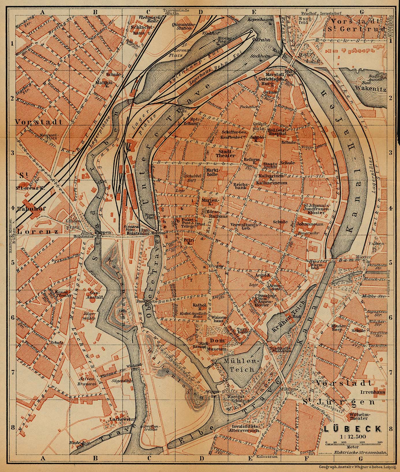
Deutsch: Stadtkarte von Lübeck um 1910 vom Baedeker Verlag
English: City Map of Lübeck, Germany, 1910, by Baedeker |
| Data | |
| Źródło | http://www.lib.utexas.edu/maps/historical/baedeker_n_germany_1910/lubeck_1910.jpg |
| Autor | "Northern Germany as far as the Bavarian and Austrian Frontiers; Handbook for Travellers" by Karl Baedeker. Fifteenth Revised Edition. Leipzig, Karl Baedeker; New York, Charles Scribner's Sons 1910. |
| Licencja (Ponowne użycie tego pliku) |
"Courtesy of the University of Texas Libraries, The University of Texas at Austin." http://www.lib.utexas.edu/maps/map_sites/hist_sites.html |
| Inne wersje |
original is a duplicate of File:Lubeck 1910.jpg |

Licencja
|
Ten materiał przeszedł do domeny publicznej w kraju pochodzenia, jak również w państwach i terytoriach, gdzie prawo autorskie wygasa w ciągu 70 lat po śmierci autora.
| |
| Plik rozpoznano jako wolny od znanych ograniczeń praw autorskich, włącznie z prawami zależnymi i pokrewnymi. | |
⧼Abusefilter-links⧽
Historia pliku
Kliknij na datę/czas, aby zobaczyć, jak plik wyglądał w tym czasie.
| Data i czas | Miniatura | Wymiary | Użytkownik | Opis | |
|---|---|---|---|---|---|
| aktualny | 16:14, 20 lut 2019 | | 1386 × 1632 (1,74 MB) | 1970gemini | entschleiert |
| 01:20, 27 maj 2006 |  | 1386 × 1632 (876 KB) | 700 MB | even more | |
| 00:53, 27 maj 2006 |  | 1386 × 1632 (1,15 MB) | 700 MB | tried to remove the stain | |
| 03:56, 23 kwi 2006 |  | 1386 × 1632 (810 KB) | 700 MB | {{Information| |Description=City Map of Lübeck, Germany, 1910 |Source=http://www.lib.utexas.edu/maps/historical/baedeker_n_germany_1910/lubeck_1910.jpg |Date=1910 |Author="Northern Germany as far as the Bavarian and Austrian Frontiers; Handbook for Trave |
Lokalne wykorzystanie pliku
Poniższa strona korzysta z tego pliku:
Globalne wykorzystanie pliku
Ten plik jest wykorzystywany także w innych projektach wiki:
- Wykorzystanie na azb.wikipedia.org
- Wykorzystanie na ca.wikipedia.org
- Wykorzystanie na de.wikipedia.org
- Wykorzystanie na he.wikipedia.org