
Plik:NepalBajuraDistrictmap.png
Rozmiar pierwotny (2479 × 3508 pikseli, rozmiar pliku: 249 KB, typ MIME: image/png)
| Plik NepalBajuraDistrictmap.png znajduje się w Wikimedia Commons – repozytorium wolnych zasobów. Dane z jego strony opisu znajdują się poniżej. |
| Opis |
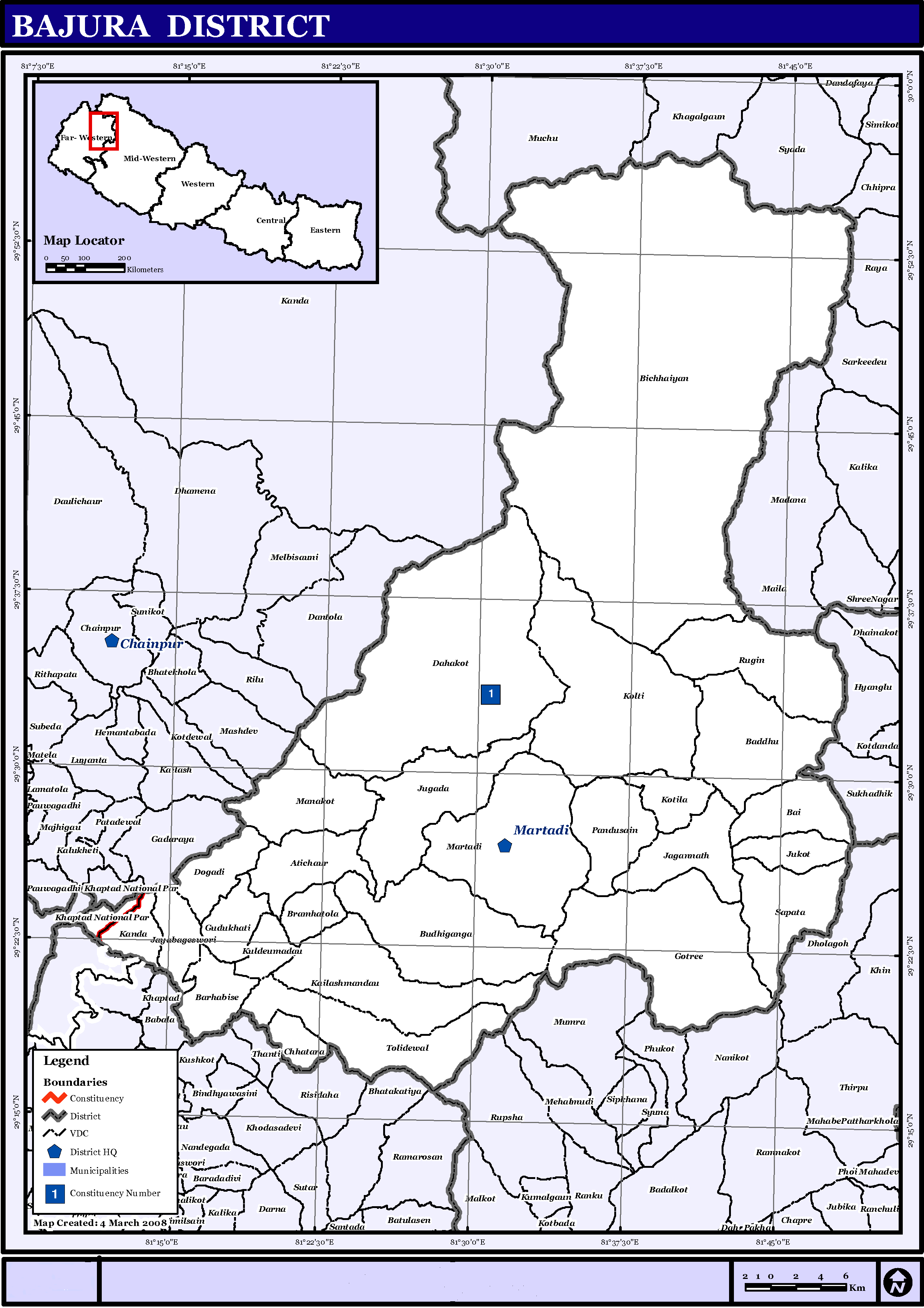
English: Map displaying Village Development Committees in Bajura District, Nepal |
|||
| Data | ||||
| Źródło | http://www.un.org.np/maps/district-maps/far-western/Bajura.pdf | |||
| Autor | United Nations | |||
| Licencja (Ponowne użycie tego pliku) |
|

Historia pliku
Kliknij na datę/czas, aby zobaczyć, jak plik wyglądał w tym czasie.
| Data i czas | Miniatura | Wymiary | Użytkownik | Opis | |
|---|---|---|---|---|---|
| aktualny | 17:21, 21 maj 2016 | | 2479 × 3508 (249 KB) | Timeshifter | Removed UN logo and info. Only UN maps without UN info are allowed. |
| 03:40, 6 lis 2008 |  | 2479 × 3508 (272 KB) | Sadalmelik | {{Information |Description={{en|1=Map displaying Village Development Committees in Bajura District, Nepal}} |Source=http://www.un.org.np/maps/district-maps/far-western/Bajura.pdf |Date=March 4, 2008 |Author=United Nations |Permission={{PD-UN}} |other_ |
Lokalne wykorzystanie pliku
Poniższa strona korzysta z tego pliku:
Globalne wykorzystanie pliku
Ten plik jest wykorzystywany także w innych projektach wiki:
- Wykorzystanie na de.wikipedia.org
- Wykorzystanie na en.wikipedia.org
- Wykorzystanie na fi.wikipedia.org
- Wykorzystanie na it.wikipedia.org
- Wykorzystanie na mai.wikipedia.org
- Wykorzystanie na ms.wikipedia.org
- Wykorzystanie na ne.wikipedia.org
Pokaż listę globalnego wykorzystania tego pliku.