
Plik:Newbold, Leicestershire - geograph.org.uk - 373338.jpg
Grafika w wyższej rozdzielczości nie jest dostępna.
Newbold,_Leicestershire_-_geograph.org.uk_-_373338.jpg (640 × 427 pikseli, rozmiar pliku: 98 KB, typ MIME: image/jpeg)
| Plik Newbold, Leicestershire - geograph.org.uk - 373338.jpg znajduje się w Wikimedia Commons – repozytorium wolnych zasobów. Dane z jego strony opisu znajdują się poniżej. |
Opis
| Opis |
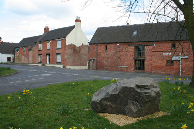
English: Newbold, Leicestershire This road junction is just inside the featured square according to the 1:25,000 OS map. The main village street is Worthington Lane to the left and School Lane to the right. The street joining at the junction is Ashby Road. The large boulder is of the local stone; there are numerous quarries in the area, both working and disused, the nearest being at Cloud Hill in SK4121. |
| Data | |
| Źródło | From geograph.org.uk |
| Autor | Kate Jewell |
| Uznanie autorstwa (wymagana przez licencję) | Kate Jewell / Newbold, Leicestershire / |
| Pozycja fotografa | | To i inne zdjęcia na: OpenStreetMap |
|---|
_heading:67.00&language=pl)
| Pozycja obiektu | | To i inne zdjęcia na: OpenStreetMap |
|---|
_heading:67.00&language=pl)
Licencja

|
Ta grafika pochodzi z kolekcji projektu Geograph. Aby zobaczyć szczegóły możesz odwiedzić stronę tego zdjęcia w serwisie Geograph. Prawa autorskie do tej grafiki posiada Kate Jewell i jest ona udostępniona na licencji Creative Commons Uznanie autorstwa – Na tych samych warunkach 2.0.
|
Ten plik udostępniony jest na licencji Creative Commons Uznanie autorstwa – Na tych samych warunkach 2.0.
Uznanie autorstwa: Kate Jewell
- Wolno:
- dzielić się – kopiować, rozpowszechniać, odtwarzać i wykonywać utwór
- modyfikować – tworzyć utwory zależne
- Na następujących warunkach:
- uznanie autorstwa – musisz określić autorstwo utworu, podać link do licencji, a także wskazać czy utwór został zmieniony. Możesz to zrobić w każdy rozsądny sposób, o ile nie będzie to sugerować, że licencjodawca popiera Ciebie lub Twoje użycie utworu.
- na tych samych warunkach – Jeśli zmienia się lub przekształca niniejszy utwór, lub tworzy inny na jego podstawie, można rozpowszechniać powstały w ten sposób nowy utwór tylko na podstawie tej samej lub podobnej licencji.
- Remove redundant categories and try to put this image in the most specific category/categories
- Remove this template
- The location categories are based on information from this geonames tool and this OpenStreetMap tool combined with a database. You can also have a look at this tool from mysociety.
- The topic category from Geograph was Village street (find similar images street at Geograph)
Historia pliku
Kliknij na datę/czas, aby zobaczyć, jak plik wyglądał w tym czasie.
| Data i czas | Miniatura | Wymiary | Użytkownik | Opis | |
|---|---|---|---|---|---|
| aktualny | 23:06, 4 sty 2011 | | 640 × 427 (98 KB) | GeographBot | == {{int:filedesc}} == {{Information |description={{en|1=Newbold, Leicestershire This road junction is just inside the featured square according to the 1:25,000 OS map. The main village street is Worthington Lane to the left and School Lane to the right. |
Lokalne wykorzystanie pliku
Poniższa strona korzysta z tego pliku:
Globalne wykorzystanie pliku
Ten plik jest wykorzystywany także w innych projektach wiki:
- Wykorzystanie na en.wikipedia.org
- Wykorzystanie na es.wikipedia.org
- Wykorzystanie na www.wikidata.org