
Plik:Sarthe department location map.svg

Wielkość pliku podglądu PNG dla pliku SVG: 591 × 599 pikseli Inne rozdzielczości: 237 × 240 pikseli | 474 × 480 pikseli | 758 × 768 pikseli | 1010 × 1024 pikseli | 2021 × 2048 pikseli | 1179 × 1195 pikseli.
Rozmiar pierwotny (Plik SVG, nominalnie 1179 × 1195 pikseli, rozmiar pliku: 211 KB)
| Plik Sarthe department location map.svg znajduje się w Wikimedia Commons – repozytorium wolnych zasobów. Dane z jego strony opisu znajdują się poniżej. |
Opis
| Opis |
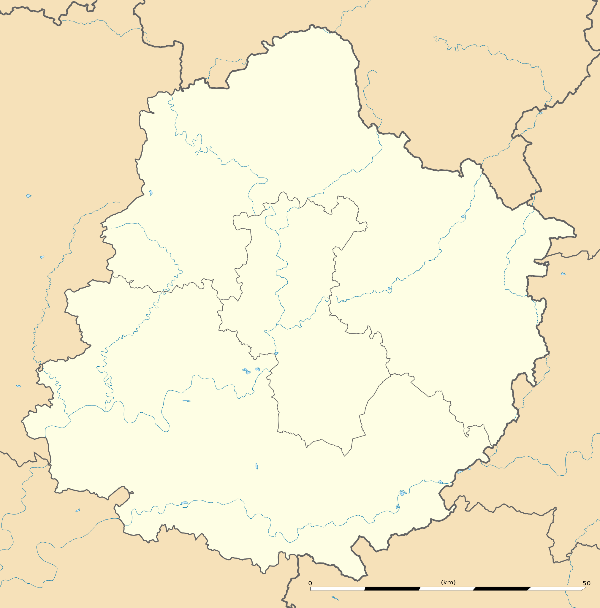
English: Blank administrative map of the department of Sarthe, France, as in February 2011, for geo-location purpose, with distinct boundaries for regions, departments and arrondissements.
Français : Carte administrative vierge du département de la Sarthe, France, telle qu'en février 2011, destinée à la géolocalisation, avec limite distincte des régions, départements et arrondissements. Estimated scale: 1:372,000 (precision: 93 m)
Geographic limits of the map:
|
||
| Data | |||
| Źródło |
Praca własna
|
||
| Autor | Eric Gaba (Sting - fr:Sting) | ||
| Licencja (Ponowne użycie tego pliku) |
|
||
| Inne wersje |
Prace pochodne od tego pliku:
|

| Pozycja fotografa | | To i inne zdjęcia na: OpenStreetMap |
|---|
Licencja
Eric Gaba, Wikimedia Commons user Sting – właściciel praw autorskich do tego dzieła, udostępnia je na poniższej licencji
Ten plik udostępniony jest na licencji Creative Commons Uznanie autorstwa – Na tych samych warunkach 3.0.
Uznanie autorstwa: Eric Gaba, Wikimedia Commons user Sting
- Wolno:
- dzielić się – kopiować, rozpowszechniać, odtwarzać i wykonywać utwór
- modyfikować – tworzyć utwory zależne
- Na następujących warunkach:
- uznanie autorstwa – musisz określić autorstwo utworu, podać link do licencji, a także wskazać czy utwór został zmieniony. Możesz to zrobić w każdy rozsądny sposób, o ile nie będzie to sugerować, że licencjodawca popiera Ciebie lub Twoje użycie utworu.
- na tych samych warunkach – Jeśli zmienia się lub przekształca niniejszy utwór, lub tworzy inny na jego podstawie, można rozpowszechniać powstały w ten sposób nowy utwór tylko na podstawie tej samej lub podobnej licencji.
Historia pliku
Kliknij na datę/czas, aby zobaczyć, jak plik wyglądał w tym czasie.
| Data i czas | Miniatura | Wymiary | Użytkownik | Opis | |
|---|---|---|---|---|---|
| aktualny | 00:36, 13 mar 2011 | | 1179 × 1195 (211 KB) | Sting | == {{int:filedesc}} == {{Information |Description={{en|Blank administrative map of the department of Sarthe, France, as in February 2011, for geo-location purpose, with distinct boundaries for regions, departments and arrondissements.}} {{f |
Lokalne wykorzystanie pliku
Z tego pliku korzysta więcej niż 100 stron. Poniższa lista pokazuje jedynie 100 pierwszych z nich. Dostępna jest również pełna lista.
- Aigné
- Aillières-Beauvoir
- Allonnes (Sarthe)
- Amné
- Ancinnes
- Ardenay-sur-Mérize
- Arnage
- Arthezé
- Arçonnay
- Asnières-sur-Vègre
- Assé-le-Boisne
- Assé-le-Riboul
- Aubigné-Racan
- Auvers-le-Hamon
- Auvers-sous-Montfaucon
- Avesnes-en-Saosnois
- Avessé
- Avezé
- Avoise
- Ballon (Sarthe)
- Bazouges-sur-le-Loir
- Beaufay
- Beaumont-Pied-de-Bœuf (Sarthe)
- Beaumont-sur-Dême
- Beaumont-sur-Sarthe
- Beillé
- Berfay
- Bernay-en-Champagne
- Bessé-sur-Braye
- Blèves
- Bonnétable
- Bouloire
- Bourg-le-Roi
- Bousse (Sarthe)
- Bouër
- Boëssé-le-Sec
- Brains-sur-Gée
- Brette-les-Pins
- Briosne-lès-Sables
- Brûlon
- Bérus
- Béthon
- Chahaignes
- Challes (Sarthe)
- Champagné
- Champfleur
- Champrond
- Changé (Sarthe)
- Chantenay-Villedieu
- Chassillé
- Chassé
- Chaufour-Notre-Dame
- Chemiré-en-Charnie
- Chemiré-le-Gaudin
- Chenay (Sarthe)
- Chenu
- Cherreau
- Cherré (Sarthe)
- Chevillé
- Château-du-Loir
- Château-l’Hermitage
- Chérancé (Sarthe)
- Chérisay
- Clermont-Créans
- Cogners
- Commerveil
- Conflans-sur-Anille
- Congé-sur-Orne
- Conlie
- Connerré
- Contilly
- Cormes
- Coudrecieux
- Coulaines
- Coulans-sur-Gée
- Coulombiers (Sarthe)
- Coulongé
- Courcebœufs
- Courcelles-la-Forêt
- Courcemont
- Courcival
- Courdemanche (Sarthe)
- Courgains
- Courgenard
- Cérans-Foulletourte
- La Bazoge (Sarthe)
- La Bosse (Sarthe)
- La Bruère-sur-Loir
- La Chapelle-Gaugain
- La Chapelle-Huon
- La Chapelle-Saint-Aubin
- La Chapelle-Saint-Fray
- La Chapelle-Saint-Rémy
- La Chapelle-aux-Choux
- La Chapelle-du-Bois
- La Chapelle-d’Aligné
- La Chartre-sur-le-Loir
- Le Bailleul
- Le Breil-sur-Mérize
- Le Chevain
Pokaż więcej odnośników do tego pliku.
Globalne wykorzystanie pliku
Ten plik jest wykorzystywany także w innych projektach wiki:
- Wykorzystanie na als.wikipedia.org
- Wykorzystanie na de.wikipedia.org
- Wykorzystanie na eo.wikipedia.org
- Ŝablono:Situo sur mapo Francio Sarthe
- La Flèche
- Château-du-Loir
- Écommoy
- Le Chevain
- Saint-Paterne
- Sargé-lès-le-Mans
- Yvré-l'Évêque
- Le Mans (stacidomo)
- Sablé-sur-Sarthe (stacidomo)
- La Ferté-Bernard (stacidomo)
- Château-du-Loir (stacidomo)
- Vivoin
- Vivoin - Beaumont (stacidomo)
- Écommoy (stacidomo)
- Montbizot (stacidomo)
- Manduel
- Redessan
- Sillé-le-Guillaume (stacidomo)
- Arnage (stacidomo)
- Champagné (stacidomo)
- Conlie (stacidomo)
- Crissé (stacidomo)
- Aubigné-Racan (stacidomo)
- Domfront (Sarthe) (stacidomo)
- La Guierche (stacidomo)
- Neuville-sur-Sarthe (stacidomo)
- Neuville-sur-Sarthe
- Teillé (stacidomo)
- Teillé (Sarthe)
- La Hutte - Coulombiers (stacidomo)
- Coulombiers (Sarthe)
- Saint-Germain-sur-Sarthe
- Le Mans Hôpital-Université (stacidomo)
- La Suze (stacidomo)
- Connerré - Beillé (stacidomo)
- Voivres (stacidomo)
- Vaas (stacidomo)
- Montfort-le-Gesnois (stacidomo)
- Montfort-le-Gesnois
- Rouessé-Vassé (stacidomo)
- Saint-Mars-la-Brière (stacidomo)
- Sceaux - Boëssé (stacidomo)
- Noyen (stacidomo)
Pokaż listę globalnego wykorzystania tego pliku.