
Plik:St Lucie Inlet aerial view.jpg
Rozmiar podglądu – 800 × 504 pikseli. Inne rozdzielczości: 320 × 202 pikseli | 640 × 403 pikseli | 1024 × 645 pikseli | 1500 × 945 pikseli.
Rozmiar pierwotny (1500 × 945 pikseli, rozmiar pliku: 120 KB, typ MIME: image/jpeg)
| Plik St Lucie Inlet aerial view.jpg znajduje się w Wikimedia Commons – repozytorium wolnych zasobów. Dane z jego strony opisu znajdują się poniżej. |
| Opis |
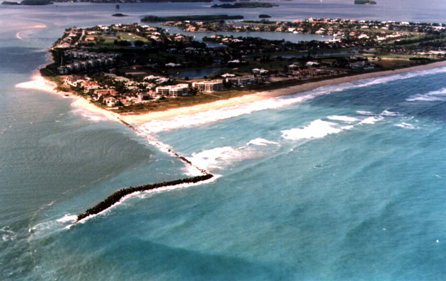
English: Aerial view of Sailfish Point and the St. Lucie Inlet in Martin County, Florida, USA. The inlet is an entrance from the Atlantic Ocean to the Indian River Lagoon and the St. Lucie River. View is to the northwest from over the Atlantic Ocean.
Coordinates: 27°9′58″N 80°9′24″W / 27.16611°N 80.15667°W |
|||
| Miejsce | Hrabstwo Martin | |||
| Data | not specified or unknown | |||
| Źródło |
U.S. Army Corps of Engineers Digital Visual Library Image page Image description page Digital Visual Library home page |
|||
| Autor | Tony Santana, U.S. Army Corps of Engineers | |||
| Licencja (Ponowne użycie tego pliku) |
|
Historia pliku
Kliknij na datę/czas, aby zobaczyć, jak plik wyglądał w tym czasie.
| Data i czas | Miniatura | Wymiary | Użytkownik | Opis | |
|---|---|---|---|---|---|
| aktualny | 05:20, 27 kwi 2007 | | 1500 × 945 (120 KB) | DanMS | {{Information | Description = {{en|Aerial view of St. Lucie Inlet in Martin County, Florida, USA. The inlet is an entrance from the Atlantic Ocean to the Indian River Lagoon and the city of Port St. Lucie. View is to the northwest from over the Atlanti |
Lokalne wykorzystanie pliku
Poniższa strona korzysta z tego pliku:
Globalne wykorzystanie pliku
Ten plik jest wykorzystywany także w innych projektach wiki:
- Wykorzystanie na ar.wikipedia.org
- Wykorzystanie na ca.wikipedia.org
- Wykorzystanie na ceb.wikipedia.org
- Wykorzystanie na ce.wikipedia.org
- Wykorzystanie na en.wikipedia.org
- Wykorzystanie na es.wikipedia.org
- Wykorzystanie na eu.wikipedia.org
- Wykorzystanie na fa.wikipedia.org
- Wykorzystanie na fr.wikipedia.org
- Wykorzystanie na it.wikipedia.org
- Wykorzystanie na ja.wikipedia.org
- Wykorzystanie na lld.wikipedia.org
- Wykorzystanie na pt.wikipedia.org
- Wykorzystanie na ru.wikipedia.org
- Wykorzystanie na sr.wikipedia.org
- Wykorzystanie na tr.wikipedia.org
- Wykorzystanie na tt.wikipedia.org
- Wykorzystanie na uk.wikipedia.org
- Wykorzystanie na uz.wikipedia.org
- Wykorzystanie na www.wikidata.org
- Wykorzystanie na zh-min-nan.wikipedia.org