
Plik:Village Hall at Jacobs Well - geograph.org.uk - 52889.jpg
Grafika w wyższej rozdzielczości nie jest dostępna.
Village_Hall_at_Jacobs_Well_-_geograph.org.uk_-_52889.jpg (640 × 427 pikseli, rozmiar pliku: 72 KB, typ MIME: image/jpeg)
| Plik Village Hall at Jacobs Well - geograph.org.uk - 52889.jpg znajduje się w Wikimedia Commons – repozytorium wolnych zasobów. Dane z jego strony opisu znajdują się poniżej. |
Opis
| Opis |
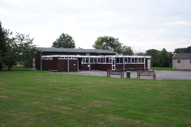
English: Village Hall at Jacobs Well. Jacobs Well was originally a small settlement around the junction of Clay Lane and the road to Sutton Green, not far from the River Wey. Today suburban bungalows and cul-de-sacs have sprung up and it is virtually on the outskirts of Guildford. In the fields close to the village can be seen the remains of a remarkable irrigation system developed by Sir Richard Weston in the first half of the 17th century. This led to the construction of the Wey Navigation, which is now owned by the National Trust. |
| Data | |
| Źródło | From geograph.org.uk |
| Autor | Ron Strutt |
| Uznanie autorstwa (wymagana przez licencję) | Ron Strutt / Village Hall at Jacobs Well / |
| Pozycja obiektu | | To i inne zdjęcia na: OpenStreetMap |
|---|
_&language=pl)
Licencja

|
Ta grafika pochodzi z kolekcji projektu Geograph. Aby zobaczyć szczegóły możesz odwiedzić stronę tego zdjęcia w serwisie Geograph. Prawa autorskie do tej grafiki posiada Ron Strutt i jest ona udostępniona na licencji Creative Commons Uznanie autorstwa – Na tych samych warunkach 2.0.
|
Ten plik udostępniony jest na licencji Creative Commons Uznanie autorstwa – Na tych samych warunkach 2.0.
Uznanie autorstwa: Ron Strutt
- Wolno:
- dzielić się – kopiować, rozpowszechniać, odtwarzać i wykonywać utwór
- modyfikować – tworzyć utwory zależne
- Na następujących warunkach:
- uznanie autorstwa – musisz określić autorstwo utworu, podać link do licencji, a także wskazać czy utwór został zmieniony. Możesz to zrobić w każdy rozsądny sposób, o ile nie będzie to sugerować, że licencjodawca popiera Ciebie lub Twoje użycie utworu.
- na tych samych warunkach – Jeśli zmienia się lub przekształca niniejszy utwór, lub tworzy inny na jego podstawie, można rozpowszechniać powstały w ten sposób nowy utwór tylko na podstawie tej samej lub podobnej licencji.
Historia pliku
Kliknij na datę/czas, aby zobaczyć, jak plik wyglądał w tym czasie.
| Data i czas | Miniatura | Wymiary | Użytkownik | Opis | |
|---|---|---|---|---|---|
| aktualny | 22:44, 30 sty 2010 | | 640 × 427 (72 KB) | GeographBot | == {{int:filedesc}} == {{Information |description={{en|1=Village Hall at Jacobs Well. Jacobs Well was originally a small settlement around the junction of Clay Lane and the road to Sutton Green, not far from the River Wey. Today suburban bungalows and cul |
Lokalne wykorzystanie pliku
Poniższa strona korzysta z tego pliku:
Globalne wykorzystanie pliku
Ten plik jest wykorzystywany także w innych projektach wiki:
- Wykorzystanie na azb.wikipedia.org
- Wykorzystanie na en.wikipedia.org
- Wykorzystanie na fa.wikipedia.org
- Wykorzystanie na sv.wikipedia.org
- Wykorzystanie na www.wikidata.org