
Plik:Warwickshire UK location map.svg

Wielkość pliku podglądu PNG dla pliku SVG: 493 × 599 pikseli Inne rozdzielczości: 197 × 240 pikseli | 395 × 480 pikseli | 632 × 768 pikseli | 843 × 1024 pikseli | 1686 × 2048 pikseli | 1042 × 1266 pikseli.
Rozmiar pierwotny (Plik SVG, nominalnie 1042 × 1266 pikseli, rozmiar pliku: 2,18 MB)
| Plik Warwickshire UK location map.svg znajduje się w Wikimedia Commons – repozytorium wolnych zasobów. Dane z jego strony opisu znajdują się poniżej. |
| Opis |
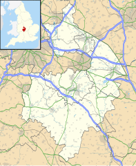
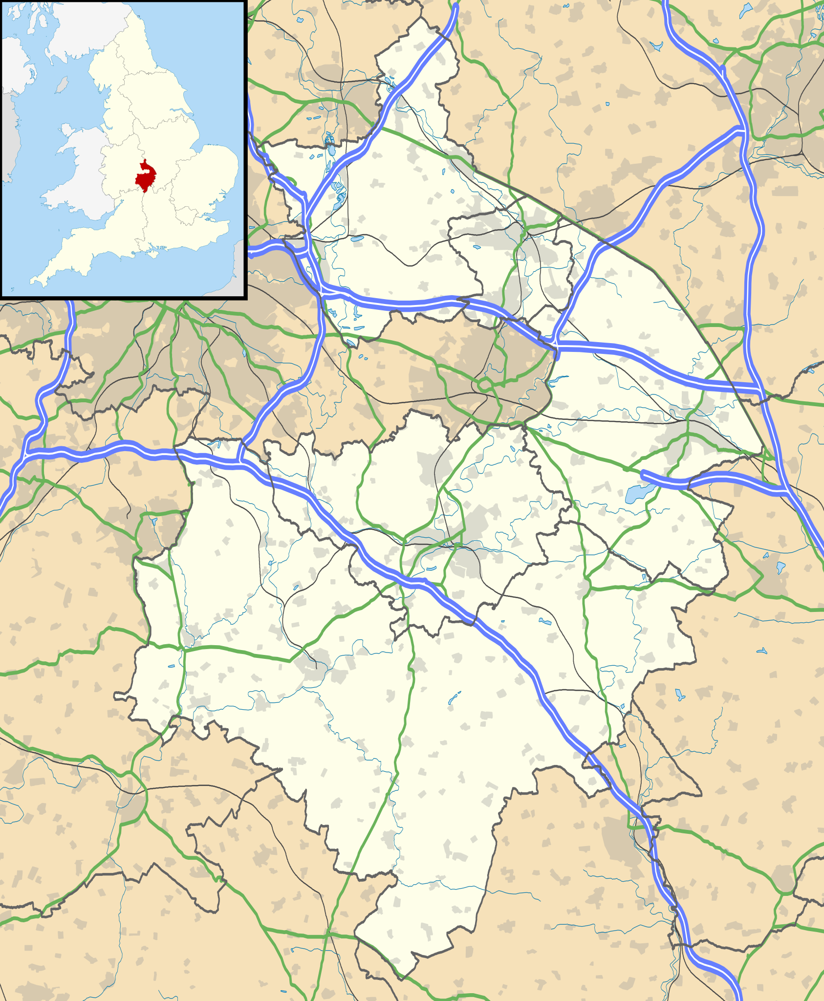
Map of Warwickshire, UK with the following information shown:
Equirectangular map projection on WGS 84 datum, with N/S stretched 160% Geographic limits:
|
| Data | |
| Źródło |
|
| Autor | Nilfanion, created using Ordnance Survey data |
| Licencja (Ponowne użycie tego pliku) |
Ten plik udostępniony jest na licencji Creative Commons Uznanie autorstwa – Na tych samych warunkach 3.0. Uznanie autorstwa: Contains Ordnance Survey data © Crown copyright and database right
|
| Inne wersje | File:Warwickshire UK district map (blank).svg - Blank map |
.svg)
Historia pliku
Kliknij na datę/czas, aby zobaczyć, jak plik wyglądał w tym czasie.
| Data i czas | Miniatura | Wymiary | Użytkownik | Opis | |
|---|---|---|---|---|---|
| aktualny | 21:17, 26 wrz 2010 | | 1042 × 1266 (2,18 MB) | Nilfanion | {{Information |Description=Map of Warwickshire, UK with the following information shown: *Administrative borders *Coastline, lakes and rivers *Roads and railways *Urban areas Equirectangular map projection on WGS 84 datum, with N/S str |
Lokalne wykorzystanie pliku
Z tego pliku korzysta więcej niż 100 stron. Poniższa lista pokazuje jedynie 100 pierwszych z nich. Dostępna jest również pełna lista.
- Abbot's Salford
- Admington
- Ailstone
- Alcester
- Alderminster
- Allen End
- Alne End
- Alvecote
- Alveston (Warwickshire)
- Anker (wieś)
- Ansley (Warwickshire)
- Ansley Common
- Ansty (Warwickshire)
- Ardens Grafton
- Arlescote
- Armscote
- Arrow (Warwickshire)
- Arrow with Weethley
- Ascott (Warwickshire)
- Ash Green (Warwickshire)
- Ashorne
- Ashow
- Astley (Warwickshire)
- Aston Cantlow
- Atherstone
- Atherstone on Stour
- Austrey
- Avon Dassett
- Baddesley Ensor
- Baginton
- Ballard’s Green
- Barcheston
- Barford (Warwickshire)
- Barnmoor Green
- Barton-on-the-Heath
- Barton (Warwickshire)
- Bascote
- Bassetts Pole
- Baxterley
- Bearley
- Beaudesert
- Beausale
- Bedworth
- Bentley (Warwickshire)
- Bentley Common
- Bidford-on-Avon
- Billesley (Warwickshire)
- Bilton (Warwickshire)
- Binley Woods
- Binton
- Birchmoor
- Birdingbury
- Bishop’s Itchington
- Bishop’s Tachbrook
- Blackdown (Warwickshire)
- Blythe End
- Bodymoor Heath
- Botts Green
- Bourton-on-Dunsmore
- Brailes
- Bramcote (Warwickshire)
- Brandon (Warwickshire)
- Bretford
- Brinklow
- Broadwell (Warwickshire)
- Brownsover
- Bubbenhall
- Buckley Green
- Budbrooke
- Bulkington (Warwickshire)
- Burmington
- Burton Dassett
- Burton Green
- Burton Hastings
- Bushwood
- Butlers Marston
- Caldecote (Warwickshire)
- Cathiron
- Cawston (Warwickshire)
- Chadwick End
- Cherington (Warwickshire)
- Chesterton (Warwickshire)
- Church Lawford
- Churchover
- Claverdon
- Clifford Chambers
- Clifton upon Dunsmore
- Coleshill (Warwickshire)
- Henley-in-Arden
- Nuneaton
- Nuneaton (stacja kolejowa)
- Port lotniczy Coventry
- Royal Leamington Spa
- Rugby (miasto)
- Rugby (stacja kolejowa)
- Shipston-on-Stour
- Southam
- Stratford-upon-Avon
- Warwick
- Warwickshire
Pokaż więcej odnośników do tego pliku.
Globalne wykorzystanie pliku
Ten plik jest wykorzystywany także w innych projektach wiki:
- Wykorzystanie na ar.wikipedia.org
- Wykorzystanie na bg.wikipedia.org
- Wykorzystanie na ceb.wikipedia.org
- Wykorzystanie na en.wikipedia.org
- Kenilworth Castle
- Stratford-upon-Avon
- Kenilworth
- Rugby, Warwickshire
- Battle of Edgehill
- Napton on the Hill
- Warwick Castle
- Leamington Spa
- Nuneaton
- Southam
- Warwick
- Bedworth
- Atherstone
- Mancetter
- Ryton-on-Dunsmore
- Alcester
- Shipston-on-Stour
- Dunchurch
- Warwickshire
- Wellesbourne Watermill
- Whitnash
- Bulkington
- Kineton
- Studley, Warwickshire
- Brinklow
- Monks Kirby
- Gaydon
- Leek Wootton
- Bodymoor Heath
- Compton Wynyates
- Long Compton
- Ansty, Warwickshire
- Coleshill, Warwickshire
- Broadwell, Warwickshire
- Bidford-on-Avon
- Rugby Radio Station
- Newbold-on-Avon
- Kingsbury, Warwickshire
- Binley Woods
- Long Lawford
- Willoughby, Warwickshire
- Wibtoft
- Wolston
- Newton, Warwickshire
- Burton Green
Pokaż listę globalnego wykorzystania tego pliku.