
Plik:Xinjiang Internment Map, US-Aus Gov Assessment.jpg
Rozmiar podglądu – 800 × 495 pikseli. Inne rozdzielczości: 320 × 198 pikseli | 640 × 396 pikseli | 1024 × 634 pikseli | 1280 × 792 pikseli | 2048 × 1267 pikseli.
Rozmiar pierwotny (2048 × 1267 pikseli, rozmiar pliku: 150 KB, typ MIME: image/jpeg)
| Plik Xinjiang Internment Map, US-Aus Gov Assessment.jpg znajduje się w Wikimedia Commons – repozytorium wolnych zasobów. Dane z jego strony opisu znajdują się poniżej. |
Opis
| Opis |
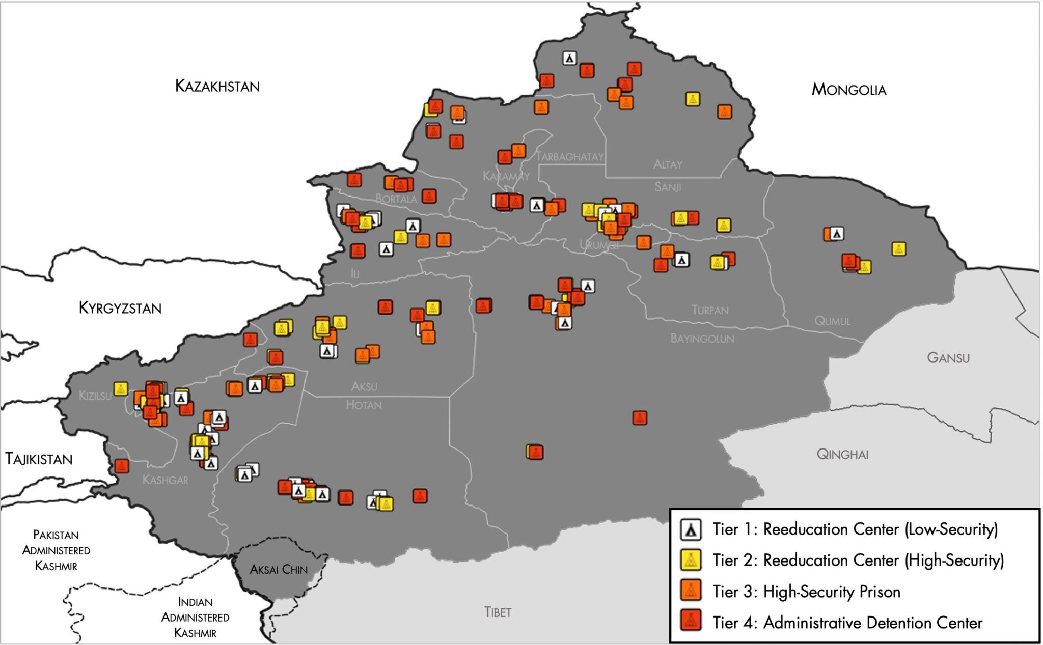
English: Map of the Xinjiang Internment Camps created by the RAND Corporation based on data collected by the US National Geospatial Intelligence Agency and the Australian Strategic Policy Institute. Open source here. |
||||||||
| Data | |||||||||
| Źródło | https://www.tearline.mil/public_page/xinjiang-nighttime-1/ | ||||||||
| Autor | National Geospatial Intelligence Agency, using data from the Australian Strategic Policy Institute, and administrative boundaries from GADM. | ||||||||
| Licencja (Ponowne użycie tego pliku) |
|


Historia pliku
Kliknij na datę/czas, aby zobaczyć, jak plik wyglądał w tym czasie.
| Data i czas | Miniatura | Wymiary | Użytkownik | Opis | |
|---|---|---|---|---|---|
| aktualny | 07:05, 2 maj 2021 | | 2048 × 1267 (150 KB) | Abovfold | Uploaded a work by {{w|National Geospatial Intelligence Agency}}, using data from the {{w|Australian Strategic Policy Institute}}, and administrative boundaries from {{w|GADM}}. from https://www.tearline.mil/public_page/xinjiang-nighttime-1/ with UploadWizard |
Lokalne wykorzystanie pliku
Następujące strony korzystają z tego pliku:
Globalne wykorzystanie pliku
Ten plik jest wykorzystywany także w innych projektach wiki:
- Wykorzystanie na ba.wikipedia.org
- Wykorzystanie na br.wikipedia.org
- Wykorzystanie na cs.wikipedia.org
- Wykorzystanie na de.wikipedia.org
- Wykorzystanie na el.wikipedia.org
- Wykorzystanie na en.wikipedia.org
- Wykorzystanie na es.wikipedia.org
- Wykorzystanie na fi.wikipedia.org
- Wykorzystanie na fr.wikipedia.org
- Wykorzystanie na ga.wikipedia.org
- Wykorzystanie na he.wikipedia.org
- Wykorzystanie na km.wikipedia.org
- Wykorzystanie na nl.wikipedia.org
- Wykorzystanie na or.wikipedia.org
- Wykorzystanie na pt.wikipedia.org
- Wykorzystanie na ru.wikinews.org
- Wykorzystanie na sv.wikipedia.org
- Wykorzystanie na szl.wikipedia.org
- Wykorzystanie na tr.wikipedia.org
- Wykorzystanie na www.wikidata.org