
Plik:Zugspitze Airview 01.jpg

Rozmiar pierwotny (2814 × 2111 pikseli, rozmiar pliku: 4,12 MB, typ MIME: image/jpeg)
| Plik Zugspitze Airview 01.jpg znajduje się w Wikimedia Commons – repozytorium wolnych zasobów. Dane z jego strony opisu znajdują się poniżej. |
Opis
| Opis |
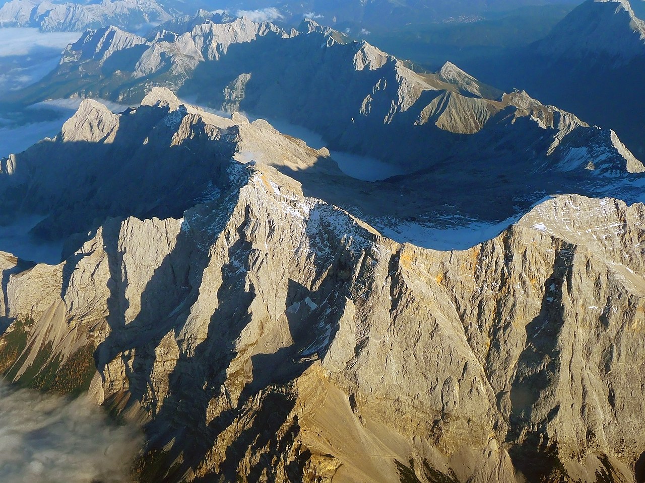
English: The "Zugspitze", the highest mountain in Germany as seen from an aircraft. View from West, with mountains in Wetterstein around and valley Reintal with fog or clouds from above.
Deutsch: Die "Zugspitze", der höchste Berg Deutschlands aus einem Flugzeug gesehen. Der Hauptgipfel des Wettersteingebirges ist umgeben von tieferliegenden Graten wie dem Jubiläumsgrat, dem Schneefernerkopf rechts neben dem Gipfel in der Mitte, mit dem Zugspitzplatt und dem steil abfallenden Reintal dahinter, die beide bereits im Schatten des späten Nachmittags liegen. Oktober mit Sonne auf dem Gipfel. |
| Data | |
| Źródło | Praca własna |
| Autor | Africaspotter |
| Pozycja fotografa | | To i inne zdjęcia na: OpenStreetMap |
|---|
Licencja
- Wolno:
- dzielić się – kopiować, rozpowszechniać, odtwarzać i wykonywać utwór
- modyfikować – tworzyć utwory zależne
- Na następujących warunkach:
- uznanie autorstwa – musisz określić autorstwo utworu, podać link do licencji, a także wskazać czy utwór został zmieniony. Możesz to zrobić w każdy rozsądny sposób, o ile nie będzie to sugerować, że licencjodawca popiera Ciebie lub Twoje użycie utworu.
- na tych samych warunkach – Jeśli zmienia się lub przekształca niniejszy utwór, lub tworzy inny na jego podstawie, można rozpowszechniać powstały w ten sposób nowy utwór tylko na podstawie tej samej lub podobnej licencji.
1. Online-Medien:
2. Print-Medien:
Ich bitte um Zusendung eines Belegexemplares bzw. der URL, wo das Foto benutzt wird. Bitte schreiben Sie eine E-Mail, wenn Sie meine Adresse für die Zusendung eines Belegexemplares benötigen oder weitergehende Fragen zur Lizenznutzung haben. Eine Auswahl meiner Fotos finden Sie auch auf www.felixgottwald.net. |
1. Online media:
2. Print media:
Please send me a specimen copy or the URL of the website where the image is used. Please write an email, if you need my postal address for sending a specimen copy or have further questions regarding the terms of licence. You may also find a selection of my photos at www.felixgottwald.net. |
| Adnotacje | To zdjęcie jest opatrzone adnotacją: Zobacz adnotacje w Commons |
Historia pliku
Kliknij na datę/czas, aby zobaczyć, jak plik wyglądał w tym czasie.
| Data i czas | Miniatura | Wymiary | Użytkownik | Opis | |
|---|---|---|---|---|---|
| aktualny | 21:00, 13 paź 2010 | | 2814 × 2111 (4,12 MB) | Africaspotter | {{Information |Description={{en|1=The "Zugspitze", the highest mountain in Germany as seen from an aircraft.}} {{de|1=Die "Zugspitze", der höchste Berg Deutschlands aus einem Flugzeug gesehen.}} |Source={{own}} |Author=[[User:Africaspotter|Africaspotter] |
Lokalne wykorzystanie pliku
Poniższa strona korzysta z tego pliku:
Globalne wykorzystanie pliku
Ten plik jest wykorzystywany także w innych projektach wiki:
- Wykorzystanie na be.wikipedia.org
- Wykorzystanie na bg.wikipedia.org
- Wykorzystanie na bs.wikipedia.org
- Wykorzystanie na cs.wikipedia.org
- Wykorzystanie na de.wikipedia.org
- Wykorzystanie na dsb.wikipedia.org
- Wykorzystanie na en.wikipedia.org
- Wykorzystanie na eo.wikipedia.org
- Wykorzystanie na et.wikipedia.org
- Wykorzystanie na eu.wikipedia.org
- Wykorzystanie na fi.wikipedia.org
- Wykorzystanie na fr.wikipedia.org
- Wykorzystanie na gl.wikipedia.org
- Wykorzystanie na he.wikipedia.org
- Wykorzystanie na hsb.wikipedia.org
- Wykorzystanie na hu.wikipedia.org
- Wykorzystanie na id.wikipedia.org
- Wykorzystanie na is.wikipedia.org
- Wykorzystanie na it.wikipedia.org
- Wykorzystanie na ja.wikipedia.org
- Wykorzystanie na lt.wikipedia.org
- Wykorzystanie na mr.wikipedia.org
- Wykorzystanie na ms.wikipedia.org
- Wykorzystanie na nl.wikipedia.org
- Wykorzystanie na no.wikipedia.org
- Wykorzystanie na pnb.wikipedia.org
- Wykorzystanie na pt.wikipedia.org
- Wykorzystanie na ro.wikipedia.org
- Wykorzystanie na simple.wikipedia.org
- Wykorzystanie na sk.wikipedia.org
- Wykorzystanie na sv.wikipedia.org
- Wykorzystanie na tr.wikipedia.org
- Wykorzystanie na uk.wikipedia.org
- Wykorzystanie na vi.wikipedia.org
- Wykorzystanie na zh.wikipedia.org