
Plik:Abemama Map.jpg

Rozmiar pierwotny (5310 × 5667 pikseli, rozmiar pliku: 1,32 MB, typ MIME: image/jpeg)
| Plik Abemama Map.jpg znajduje się w Wikimedia Commons – repozytorium wolnych zasobów. Dane z jego strony opisu znajdują się poniżej. |
Opis
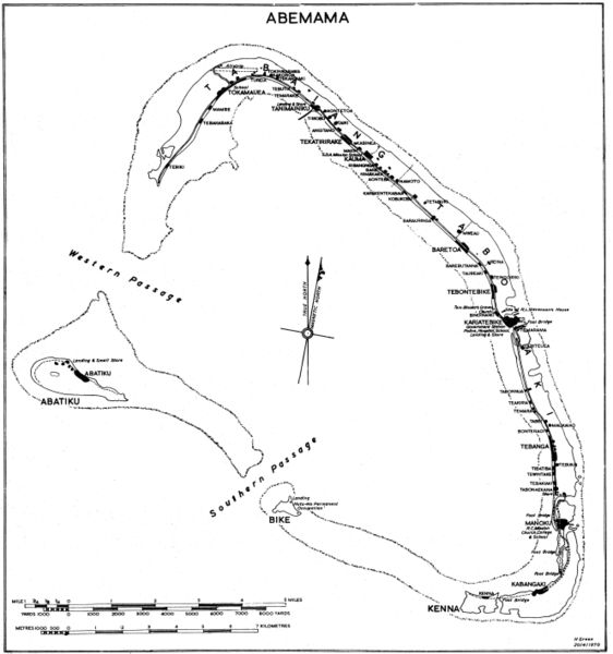
Government map (some maps in the series include the following: "Compiled by Lands and Surveys, Betio, Tarawa") with inscription "H Green 20/4/1970". Original obtained either directly from GEIDA of from a U.S. Government source (USACOE) as a blueline printing sometime in the 1970s. I believe these maps were produced for government use by the Gilbert Islands Colony. I have scanned and slightly altered the original (1/50,000 scale). Maps such as this one showing village locations on Pacific islands are difficult to come by. - Marshman 18:16, 28 November 2005 (UTC)
Licencja
Ten utwór znajduje się w domenie publicznej w Stanach Zjednoczonych, ponieważ jest utworem Rządu Federalnego Stanów Zjednoczonych w rozumieniu Tytułu 17, Rozdziału 1, Sekcji 105 Kodeksu Stanów Zjednoczonych. Zobacz także artykuł prawo autorskie.
Uwaga: Przepis niniejszy stosuje się wyłącznie do utworów Rządu Federalnego. Nie ma natomiast zastosowania do utworów jakiegokolwiek pojedynczego stanu lub terytorium (state, commonwealth, territory), utworów hrabstw (county), utworów miast i gmin (municipality) czy utworów jakiejkolwiek innej jednostki terytorialnej.
|
 | |
| Plik rozpoznano jako wolny od znanych ograniczeń praw autorskich, włącznie z prawami zależnymi i pokrewnymi. | ||
Historia pliku
Kliknij na datę/czas, aby zobaczyć, jak plik wyglądał w tym czasie.
| Data i czas | Miniatura | Wymiary | Użytkownik | Opis | |
|---|---|---|---|---|---|
| aktualny | 22:07, 28 lis 2005 | | 5310 × 5667 (1,32 MB) | Marshman~commonswiki | Slightly larger version of same |
| 20:13, 28 lis 2005 |  | 3540 × 3778 (708 KB) | Marshman~commonswiki | Government map with inscription "H Green 20/4/1970" I obtained the "original" as a blueline printing in the 1970s. I believe these maps were produced for government use by the Gilbert Islands Colony. I have scanned and slightly altered the original (1/50 |
Lokalne wykorzystanie pliku
Żadna strona nie korzysta z tego pliku.
Globalne wykorzystanie pliku
Ten plik jest wykorzystywany także w innych projektach wiki:
- Wykorzystanie na ce.wikipedia.org
- Wykorzystanie na de.wikipedia.org
- Wykorzystanie na el.wikipedia.org
- Wykorzystanie na en.wikipedia.org
- Wykorzystanie na es.wikipedia.org
- Wykorzystanie na fi.wikipedia.org
- Wykorzystanie na gl.wikipedia.org
- Wykorzystanie na he.wikipedia.org
- Wykorzystanie na hu.wikipedia.org
- Wykorzystanie na ka.wikipedia.org
- Wykorzystanie na mk.wikipedia.org
- Wykorzystanie na pt.wikipedia.org
- Wykorzystanie na ru.wikipedia.org