
Plik:Chilean coastal blooms.JPG
Rozmiar podglądu – 267 × 599 pikseli. Inne rozdzielczości: 107 × 240 pikseli | 214 × 480 pikseli | 694 × 1558 pikseli.
Rozmiar pierwotny (694 × 1558 pikseli, rozmiar pliku: 1,23 MB, typ MIME: image/jpeg)
| Plik Chilean coastal blooms.JPG znajduje się w Wikimedia Commons – repozytorium wolnych zasobów. Dane z jego strony opisu znajdują się poniżej. |
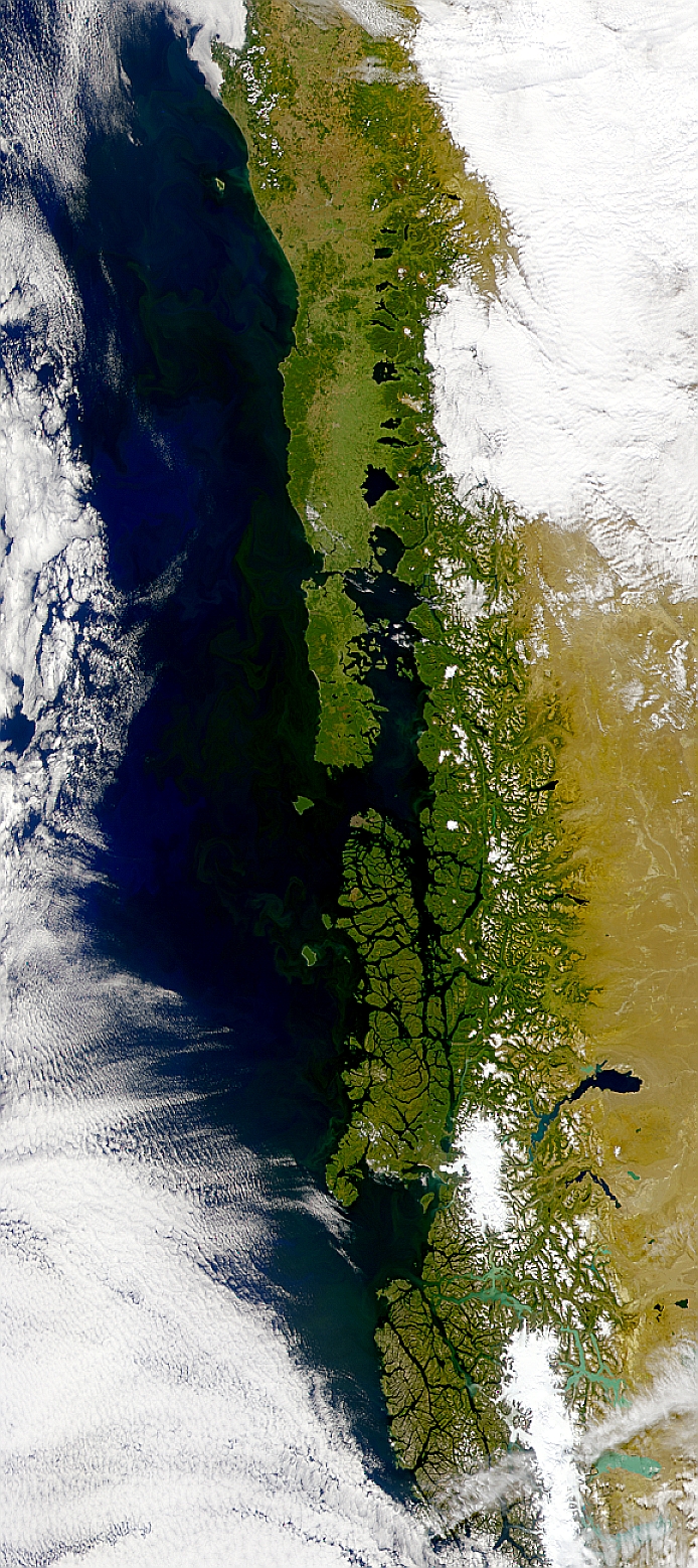
This SeaWiFS image shows phytoplankton blooms running the length of the coast of Chile.
http://visibleearth.nasa.gov/view_rec.php?id=1258 archive copy at the Wayback Machine
| This image is from the Sea-viewing Wide Field-of-view Sensor (SeaWiFS) Project and more than 5 years old.
Satellite data captured by the SeaWIFS sensor are released into the public domain 5 years after capture. Data less than five years old can be re-used only for educational or scientific purposes; any commercial use of such images must be coordinated with GeoEye. [1] |
| Ten utwór został udostępniony jako własność publiczna przez jego właściciela praw autorskich, GeoEye. Dotyczy to całego świata. W niektórych krajach może nie być to prawnie możliwe, jeśli tak, to: GeoEye zapewnia każdemu prawo do użycia tej pracy w dowolnym celu, bez żadnych ograniczeń, chyba że te ograniczenia są wymagane przez prawo.
|
Historia pliku
Kliknij na datę/czas, aby zobaczyć, jak plik wyglądał w tym czasie.
| Data i czas | Miniatura | Wymiary | Użytkownik | Opis | |
|---|---|---|---|---|---|
| aktualny | 21:18, 27 paź 2005 | | 694 × 1558 (1,23 MB) | Brian0918 | This SeaWiFS image shows phytoplankton blooms running the length of the coast of Chile. http://visibleearth.nasa.gov/view_rec.php?id=1258 {{PD-USGov-NASA}} Category:Chile |
Lokalne wykorzystanie pliku
Poniższa strona korzysta z tego pliku:
Globalne wykorzystanie pliku
Ten plik jest wykorzystywany także w innych projektach wiki:
- Wykorzystanie na ast.wikipedia.org
- Wykorzystanie na de.wikipedia.org
- Wykorzystanie na en.wikipedia.org
- Wykorzystanie na sl.wikipedia.org
- Wykorzystanie na uk.wikipedia.org