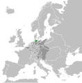
Plik:Duchy of Holstein 1789.svg

Rozmiar pierwotny (Plik SVG, nominalnie 450 × 456 pikseli, rozmiar pliku: 928 KB)
| Plik Duchy of Holstein 1789.svg znajduje się w Wikimedia Commons – repozytorium wolnych zasobów. Dane z jego strony opisu znajdują się poniżej. |
Opis
Licencja
- Wolno:
- dzielić się – kopiować, rozpowszechniać, odtwarzać i wykonywać utwór
- modyfikować – tworzyć utwory zależne
- Na następujących warunkach:
- uznanie autorstwa – musisz określić autorstwo utworu, podać link do licencji, a także wskazać czy utwór został zmieniony. Możesz to zrobić w każdy rozsądny sposób, o ile nie będzie to sugerować, że licencjodawca popiera Ciebie lub Twoje użycie utworu.
- na tych samych warunkach – Jeśli zmienia się lub przekształca niniejszy utwór, lub tworzy inny na jego podstawie, można rozpowszechniać powstały w ten sposób nowy utwór tylko na podstawie tej samej lub podobnej licencji.
Oryginalny rejestr przesyłania
This image is a derivative work of the following images:
- File:Europe_1789.svg licensed with Cc-by-sa-3.0
- 2013-04-14T03:44:26Z Alphathon 450x456 (858577 Bytes) Corrected some errors in northern Italy
- 2013-04-14T01:38:01Z Alphathon 450x456 (853881 Bytes) tweaked again
- 2013-04-14T01:36:10Z Alphathon 450x456 (853881 Bytes) Tweaked Holy Roman Empire border style
- 2013-04-14T01:33:26Z Alphathon 450x456 (853857 Bytes) == {{int:filedesc}} == {{Information |Description={{en|A blank Map of Europe circa 1789. This map also includes a border for the [[:en:Holy Roman Empire|Holy Roman Empire]]. Since there are so many small German states, they h
Uploaded with derivativeFX
Podpisy
Obiekty przedstawione na tym zdjęciu
przedstawia
14 kwi 2013
Historia pliku
Kliknij na datę/czas, aby zobaczyć, jak plik wyglądał w tym czasie.
| Data i czas | Miniatura | Wymiary | Użytkownik | Opis | |
|---|---|---|---|---|---|
| aktualny | 09:40, 17 paź 2021 |  | 450 × 456 (928 KB) | Fenn-O-maniC | Fixed the Russo-Swedish border to match the Treaty of Åbo of 1743 |
| 21:46, 18 kwi 2013 |  | 450 × 456 (948 KB) | Alphathon | Various fixes and style change | |
| 15:51, 18 kwi 2013 |  | 450 × 456 (846 KB) | Alphathon | Fixed Scandinavian borders | |
| 21:55, 14 kwi 2013 |  | 450 × 456 (831 KB) | Alphathon | == {{int:filedesc}} == {{Information |Description={{en|A map of the Duchy of Holstein circa 1789.}}{{de|Eine Landkarte die Herzogtum Holstein c. 1789.}} |Source={{Derived from|Europe_1789.svg|display... |
Lokalne wykorzystanie pliku
Następujące strony korzystają z tego pliku:
Globalne wykorzystanie pliku
Ten plik jest wykorzystywany także w innych projektach wiki:
- Wykorzystanie na ar.wikipedia.org
- Wykorzystanie na az.wikipedia.org
- Wykorzystanie na cs.wikipedia.org
- Wykorzystanie na el.wikipedia.org
- Wykorzystanie na en.wikipedia.org
- Wykorzystanie na eo.wikipedia.org
- Wykorzystanie na et.wikipedia.org
- Wykorzystanie na fa.wikipedia.org
- Wykorzystanie na fi.wikipedia.org
- Wykorzystanie na fr.wikipedia.org
- Wykorzystanie na he.wikipedia.org
- Wykorzystanie na id.wikipedia.org
- Wykorzystanie na mk.wikipedia.org
- Wykorzystanie na ru.wikipedia.org
- Wykorzystanie na tr.wikipedia.org
- Wykorzystanie na uk.wikipedia.org
- Wykorzystanie na www.wikidata.org
- Wykorzystanie na zh.wikipedia.org
Metadane
Niniejszy plik zawiera dodatkowe informacje, prawdopodobnie dodane przez aparat cyfrowy lub skaner użyte do wygenerowania tego pliku.
Jeśli plik był modyfikowany, dane mogą być częściowo niezgodne z parametrami zmodyfikowanego pliku.
| Krótki tytuł | A map of Holstein within the Holy Roman Empire and Europe ca. 1789 |
|---|---|
| Tytuł lub opis obrazu | A map of the Duchy of Holstein within the Holy Roman Empire, and within Europe, circa 1789. This map is licensed under the Creative Commons Attribution-Share Alike 3.0 Unported license (https://creativecommons.org/licenses/by-sa/3.0/) by the wikimedia user "Alphathon" (http://commons.wikimedia.org/wiki/User:Alphathon), and is based upon "Blank map of Europe.svg" (http://commons.wikimedia.org/wiki/File:Blank_map_of_Europe.svg), the details of which follow:
A blank Map of Europe. Every country has an id which is its ISO-3166-1-ALPHA2 code in lower case. Members of the EU have a class="eu", countries in europe (which I found turkey to be but russia not) have a class="europe". Certain countries are further subdivided the United Kingdom has gb-gbn for Great Britain and gb-nir for Northern Ireland. Russia is divided into ru-kgd for the Kaliningrad Oblast and ru-main for the Main body of Russia. There is the additional grouping #xb for the "British Islands" (the UK with its Crown Dependencies - Jersey, Guernsey and the Isle of Man) Contributors. Original Image: (http://commons.wikimedia.org/wiki/Image:Europe_countries.svg) Júlio Reis (http://commons.wikimedia.org/wiki/User:Tintazul). Recolouring and tagging with country codes: Marian "maix" Sigler (http://commons.wikimedia.org/wiki/User:Maix) Improved geographical features: http://commons.wikimedia.org/wiki/User:W!B: Updated to reflect dissolution of Serbia & Montenegro: http://commons.wikimedia.org/wiki/User:Zirland Updated to include British Crown Dependencies as seperate entities and regroup them as "British Islands", with some simplifications to the XML and CSS: James Hardy (http://commons.wikimedia.org/wiki/User:MrWeeble) Validated (http://commons.wikimedia.org/wiki/User:CarolSpears) Changed the country code of Serbia to RS per http://en.wikipedia.org/wiki/Serbian_country_codes and the file http://www.iso.org/iso/iso3166_en_code_lists.txt (http://commons.wikimedia.org/wiki/User:TimothyBourke) Uploaded on behalf of User:Checkit, direct complaints to him plox: 'Moved countries out of the "outlines" group, removed "outlines" style class, remove separate style information for Russia' (http://commons.wikimedia.org/wiki/User:Collard) Updated various coastlines and boarders and added various islands not previously shown (details follow). Added Kosovo and Northern Cyprus as disputed territories. Moved major lakes to their own object and added more. List of updated boarders/coastlines: British Isles (+ added Isle of Wight, Skye, various smaller islands), the Netherlands, Germany, Czech Republic, Denmark, Sweden, Finland, Poland, Kaliningrad Oblast of the Russian Federation (and minor tweaks to Lithuania), Ukraine, Moldova (minor), Romania, Bulgaria, Turkey, Greece, F.Y.R. Macedonia, Serbia, Bosnia and Herzegovina, Montenegro, Albania, Croatia, Italy (mainland and Sicily), Malta (http://commons.wikimedia.org/wiki/User:Alphathon). Added Bornholm (http://commons.wikimedia.org/wiki/User:Heb) Released under CreativeCommons Attribution ShareAlike (http://creativecommons.org/licenses/by-sa/2.5/). |
| Szerokość | 450 |
| Wysokość | 456 |


