
Plik:Karte Ravennat.jpg

Rozmiar pierwotny (2448 × 3264 pikseli, rozmiar pliku: 3,9 MB, typ MIME: image/jpeg)
| Plik Karte Ravennat.jpg znajduje się w Wikimedia Commons – repozytorium wolnych zasobów. Dane z jego strony opisu znajdują się poniżej. |
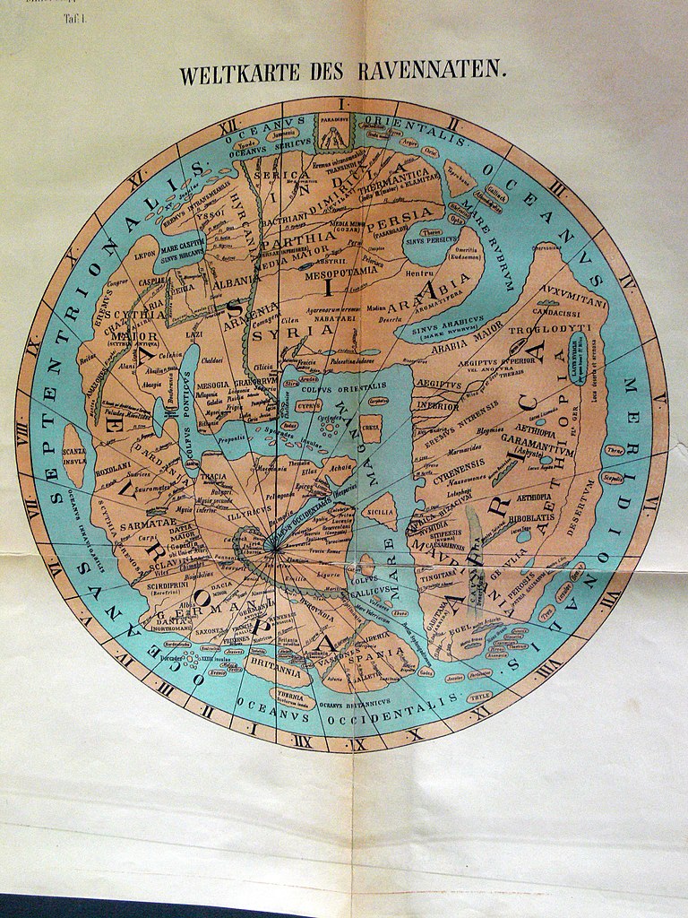
Opis
| Opis |
Deutsch: Weltkarte des anonymen Ravennaten
English: World map of anonymous Ravennaten |
| Data | |
| Źródło |
|
| Autor | Dr. Konrad Miller |
| Inne wersje | Prace pochodne od tego pliku: Ravenna Cosmography 1889 Africa crop.jpg |
Licencja
|
Ten materiał przeszedł do domeny publicznej w kraju pochodzenia, jak również w państwach i terytoriach, gdzie prawo autorskie wygasa w ciągu 70 lat po śmierci autora.
| |
| Plik rozpoznano jako wolny od znanych ograniczeń praw autorskich, włącznie z prawami zależnymi i pokrewnymi. | |
Historia pliku
Kliknij na datę/czas, aby zobaczyć, jak plik wyglądał w tym czasie.
| Data i czas | Miniatura | Wymiary | Użytkownik | Opis | |
|---|---|---|---|---|---|
| aktualny | 21:55, 13 maj 2008 | | 2448 × 3264 (3,9 MB) | Fingalo | == Beschreibung == {{Information |Description=Weltkarte des anonymen Ravennaten |Source=Mappae Mundi Bd. Vi. "Rekonstruierte Karten" |Date=1898 |Author=Dr. Konrad Miller |Permission= |other_versions= }} Category:Fingalo Category:Old maps == [[Comm |
Lokalne wykorzystanie pliku
Poniższa strona korzysta z tego pliku:
Globalne wykorzystanie pliku
Ten plik jest wykorzystywany także w innych projektach wiki:
- Wykorzystanie na ar.wikipedia.org
- Wykorzystanie na ca.wikipedia.org
- Wykorzystanie na da.wikipedia.org
- Wykorzystanie na de.wikipedia.org
- Wykorzystanie na en.wikipedia.org
- Wykorzystanie na eo.wikipedia.org
- Wykorzystanie na es.wikipedia.org
- Wykorzystanie na eu.wikipedia.org
- Wykorzystanie na fi.wikipedia.org
- Wykorzystanie na fr.wikipedia.org
- Wykorzystanie na gl.wikipedia.org
- Wykorzystanie na he.wikipedia.org
- Wykorzystanie na hr.wikipedia.org
- Wykorzystanie na hu.wikipedia.org
- Wykorzystanie na it.wikipedia.org
- Wykorzystanie na no.wikipedia.org
- Wykorzystanie na ru.wikipedia.org
- Wykorzystanie na sl.wikipedia.org
- Wykorzystanie na sq.wikipedia.org
- Wykorzystanie na sr.wikipedia.org
- Wykorzystanie na tr.wikipedia.org
- Wykorzystanie na www.wikidata.org