
Plik:SG-Settlements.png

Rozmiar podglądu – 800 × 580 pikseli. Inne rozdzielczości: 320 × 232 pikseli | 640 × 464 pikseli | 1024 × 742 pikseli | 1280 × 928 pikseli | 2560 × 1856 pikseli | 3702 × 2684 pikseli.
Rozmiar pierwotny (3702 × 2684 pikseli, rozmiar pliku: 419 KB, typ MIME: image/png)
| Plik SG-Settlements.png znajduje się w Wikimedia Commons – repozytorium wolnych zasobów. Dane z jego strony opisu znajdują się poniżej. |
Opis
| Opis |
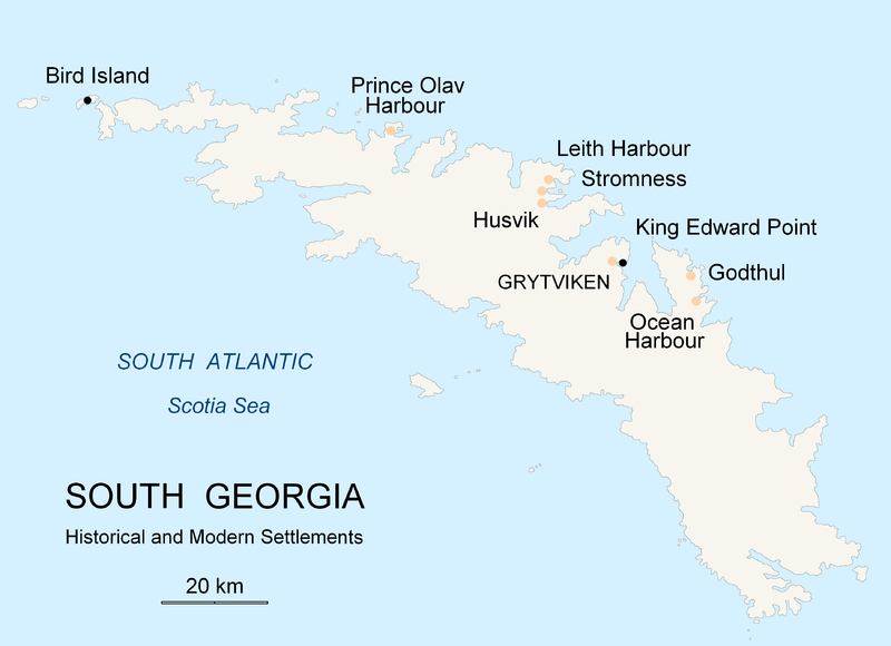
English: Map of South Georgia Island (Settlements) published by the author Apcbg. |
| Data | |
| Źródło | Praca własna |
| Autor | Apcbg |
Licencja
Ja, właściciel praw autorskich do tego dzieła, udostępniam je na poniższej licencji

|
Udziela się zgody na kopiowanie, rozpowszechnianie oraz modyfikowanie tego dokumentu zgodnie z warunkami GNU Licencji Wolnej Dokumentacji, w wersji 1.2 lub nowszej opublikowanej przez Free Software Foundation; bez niezmiennych sekcji, bez treści umieszczonych na frontowej lub tylnej stronie okładki. Kopia licencji załączona jest w sekcji zatytułowanej GNU Licencja Wolnej Dokumentacji. |
| Ten plik udostępniony jest na licencji Creative Commons Uznanie autorstwa – Na tych samych warunkach 3.0. | ||
| ||
| Ten szablon został dodany jako element zmiany licencjonowania. |
Historia pliku
Kliknij na datę/czas, aby zobaczyć, jak plik wyglądał w tym czasie.
| Data i czas | Miniatura | Wymiary | Użytkownik | Opis | |
|---|---|---|---|---|---|
| aktualny | 22:26, 18 lis 2007 | | 3702 × 2684 (419 KB) | Apcbg | {{Information |Description=Map of South Georgia Island (Settlements) published by the author Apcbg. |Source=self-made |Date=18 November 2007 |Author= Apcbg }} == Licensing == {{self|GFDL}} |
| 22:16, 18 lis 2007 |  | 3702 × 2684 (419 KB) | Apcbg | {{Information |Description=Map of South Georgia Island (Settlements) published by the author Apcbg. |Source=self-made |Date=18 November 2007 |Author= Apcbg }} == Licensing == {{self|GFDL}} | |
| 20:23, 18 lis 2007 |  | 3702 × 2684 (419 KB) | Apcbg | {{Information |Description=Map of South Georgia Island (Settlements) published by the author Apcbg. |Source=self-made |Date=18 November 2007 |Author= Apcbg }} == Licensing == {{self|GFDL}} | |
| 13:00, 7 paź 2007 |  | 2962 × 1952 (164 KB) | Apcbg | {{Information |Description=Map of South Georgia Island (Settlements) published by the author Apcbg. |Source=self-made |Date=7 October 2007 |Author= Apcbg }} == Licensing == {{self|GFDL}} | |
| 12:32, 7 paź 2007 |  | 2962 × 1952 (164 KB) | Apcbg | {{Information |Description=Map of South Georgia Island (Settlements) published by the author Apcbg. |Source=self-made |Date=7 October 2007 |Author= Apcbg }} == Licensing == {{self|GFDL}} | |
| 10:42, 7 paź 2007 |  | 2962 × 1952 (163 KB) | Apcbg | {{Information |Description=Map of South Georgia Island (Settlements) published by the author Apcbg. |Source=self-made |Date=7 October 2007 |Author= Apcbg }} == Licensing == {{self|GFDL}} | |
| 23:55, 5 paź 2007 |  | 2962 × 1952 (16,57 MB) | Apcbg | {{Information |Description=Map of South Georgia Island (Settlements) published by the author Apcbg. |Source=self-made |Date=5 October 2007 |Author= Apcbg }} == Licensing == {{self|GFDL}} | |
| 23:36, 5 paź 2007 |  | 2962 × 1952 (211 KB) | Apcbg | {{Information |Description=Map of South Georgia Island (Settlements) published by the author Apcbg. |Source=self-made |Date=5 October 2007 |Author= Apcbg }} == Licensing == {{self|GFDL}} |
Lokalne wykorzystanie pliku
Poniższa strona korzysta z tego pliku:
Globalne wykorzystanie pliku
Ten plik jest wykorzystywany także w innych projektach wiki:
- Wykorzystanie na af.wikipedia.org
- Wykorzystanie na ar.wikipedia.org
- Wykorzystanie na bg.wikipedia.org
- Wykorzystanie na bs.wikipedia.org
- Wykorzystanie na ca.wikipedia.org
- Wykorzystanie na de.wikipedia.org
- Wykorzystanie na el.wikipedia.org
- Wykorzystanie na en.wikipedia.org
- South Georgia and the South Sandwich Islands
- Grytviken
- South Georgia
- King Edward Point
- Bird Island, South Georgia
- History of South Georgia and the South Sandwich Islands
- Leith Harbour
- Solveig Gunbjørg Jacobsen
- Prince Olav Harbour
- Godthul
- Ocean Harbour
- Invasion of South Georgia
- Reindeer in South Georgia
- List of settlements in South Georgia and the South Sandwich Islands
- Wykorzystanie na eo.wikipedia.org
- Wykorzystanie na es.wikipedia.org
- Wykorzystanie na et.wikipedia.org
- Wykorzystanie na fa.wikipedia.org
- Wykorzystanie na fi.wikipedia.org
- Wykorzystanie na fr.wikipedia.org
- Wykorzystanie na fy.wikipedia.org
- Wykorzystanie na gd.wikipedia.org
- Wykorzystanie na gl.wikipedia.org
- Wykorzystanie na he.wikipedia.org
- Wykorzystanie na hu.wikipedia.org
- Wykorzystanie na id.wikipedia.org
- Wykorzystanie na incubator.wikimedia.org
Pokaż listę globalnego wykorzystania tego pliku.