
Plik:Sand and gravel extraction site - geograph.org.uk - 923943.jpg
Grafika w wyższej rozdzielczości nie jest dostępna.
Sand_and_gravel_extraction_site_-_geograph.org.uk_-_923943.jpg (640 × 480 pikseli, rozmiar pliku: 174 KB, typ MIME: image/jpeg)
| Plik Sand and gravel extraction site - geograph.org.uk - 923943.jpg znajduje się w Wikimedia Commons – repozytorium wolnych zasobów. Dane z jego strony opisu znajdują się poniżej. |
Opis
| Opis |
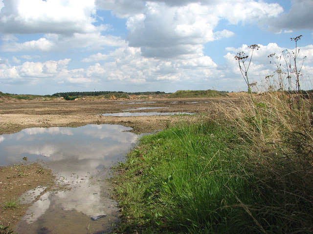
English: Sand and gravel extraction site. By Salters Lane. This gravel extraction site extends all the way along Salters Lane > 923914 until it meets Reed Lane > 923955 further to the east. Signs put up by the entrances warn that this site is not a play area > 923934. This area forms part of what used to be the parish of Launditch.
Launditch (the original spelling is Launditcth) is described in White's History, Gazetteer and Directory of Norfolk (1845) as being "of an irregular, quadrangular figure, averaging about 12 miles in length and breadth, and bounded on the north by Gallow, on the east by Eynesford, on the south by Mitford and South Greenhoe, and on the west by Freebridge-Lynn Hundred. It is a highly cultivated district, rising in some places in bold and picturesque swells, with many thriving plantations and handsome mansions, and watered by the Wensum, the Nar, and several smaller streams, which rise within its limits. It takes its name from a long ditch and bank extending from Wendling-car to the low lands near Mileham, and supposed to have been made for the purpose of carrying off the drain water. At the point where this ditch crosses the Norwich road, the Hundred court was anciently held. Launditch, (with the exception of Colkirk and Hoe) forms the Deanery of Brisley, in the Archdeaconry of Norwich." |
| Data | |
| Źródło | From geograph.org.uk |
| Autor | Evelyn Simak |
| Uznanie autorstwa (wymagana przez licencję) | Evelyn Simak / Sand and gravel extraction site / |
| Pozycja fotografa | | To i inne zdjęcia na: OpenStreetMap |
|---|
_heading:90.00&language=pl)
| Pozycja obiektu | | To i inne zdjęcia na: OpenStreetMap |
|---|
_heading:90.00&language=pl)
Licencja

|
Ta grafika pochodzi z kolekcji projektu Geograph. Aby zobaczyć szczegóły możesz odwiedzić stronę tego zdjęcia w serwisie Geograph. Prawa autorskie do tej grafiki posiada Evelyn Simak i jest ona udostępniona na licencji Creative Commons Uznanie autorstwa – Na tych samych warunkach 2.0.
|
Ten plik udostępniony jest na licencji Creative Commons Uznanie autorstwa – Na tych samych warunkach 2.0.
Uznanie autorstwa: Evelyn Simak
- Wolno:
- dzielić się – kopiować, rozpowszechniać, odtwarzać i wykonywać utwór
- modyfikować – tworzyć utwory zależne
- Na następujących warunkach:
- uznanie autorstwa – musisz określić autorstwo utworu, podać link do licencji, a także wskazać czy utwór został zmieniony. Możesz to zrobić w każdy rozsądny sposób, o ile nie będzie to sugerować, że licencjodawca popiera Ciebie lub Twoje użycie utworu.
- na tych samych warunkach – Jeśli zmienia się lub przekształca niniejszy utwór, lub tworzy inny na jego podstawie, można rozpowszechniać powstały w ten sposób nowy utwór tylko na podstawie tej samej lub podobnej licencji.
Historia pliku
Kliknij na datę/czas, aby zobaczyć, jak plik wyglądał w tym czasie.
| Data i czas | Miniatura | Wymiary | Użytkownik | Opis | |
|---|---|---|---|---|---|
| aktualny | 05:57, 22 lut 2011 | | 640 × 480 (174 KB) | GeographBot | == {{int:filedesc}} == {{Information |description={{en|1=Sand and gravel extraction site By Salters Lane. This gravel extraction site extends all the way along Salters Lane > http://www.geograph.org.uk/photo/923914 until it meets Reed Lane > http://www.ge |
Lokalne wykorzystanie pliku
Poniższa strona korzysta z tego pliku:
Globalne wykorzystanie pliku
Ten plik jest wykorzystywany także w innych projektach wiki:
- Wykorzystanie na ceb.wikipedia.org
- Wykorzystanie na cy.wikipedia.org
- Wykorzystanie na en.wikipedia.org
- Wykorzystanie na www.wikidata.org