
Plik:Frisiae, about 1600, by Ubbo Emmius.jpg
Rozmiar pierwotny (2878 × 2225 pikseli, rozmiar pliku: 1,71 MB, typ MIME: image/jpeg)
| Plik Frisiae, about 1600, by Ubbo Emmius.jpg znajduje się w Wikimedia Commons – repozytorium wolnych zasobów. Dane z jego strony opisu znajdują się poniżej. |
Opis
| Opis |
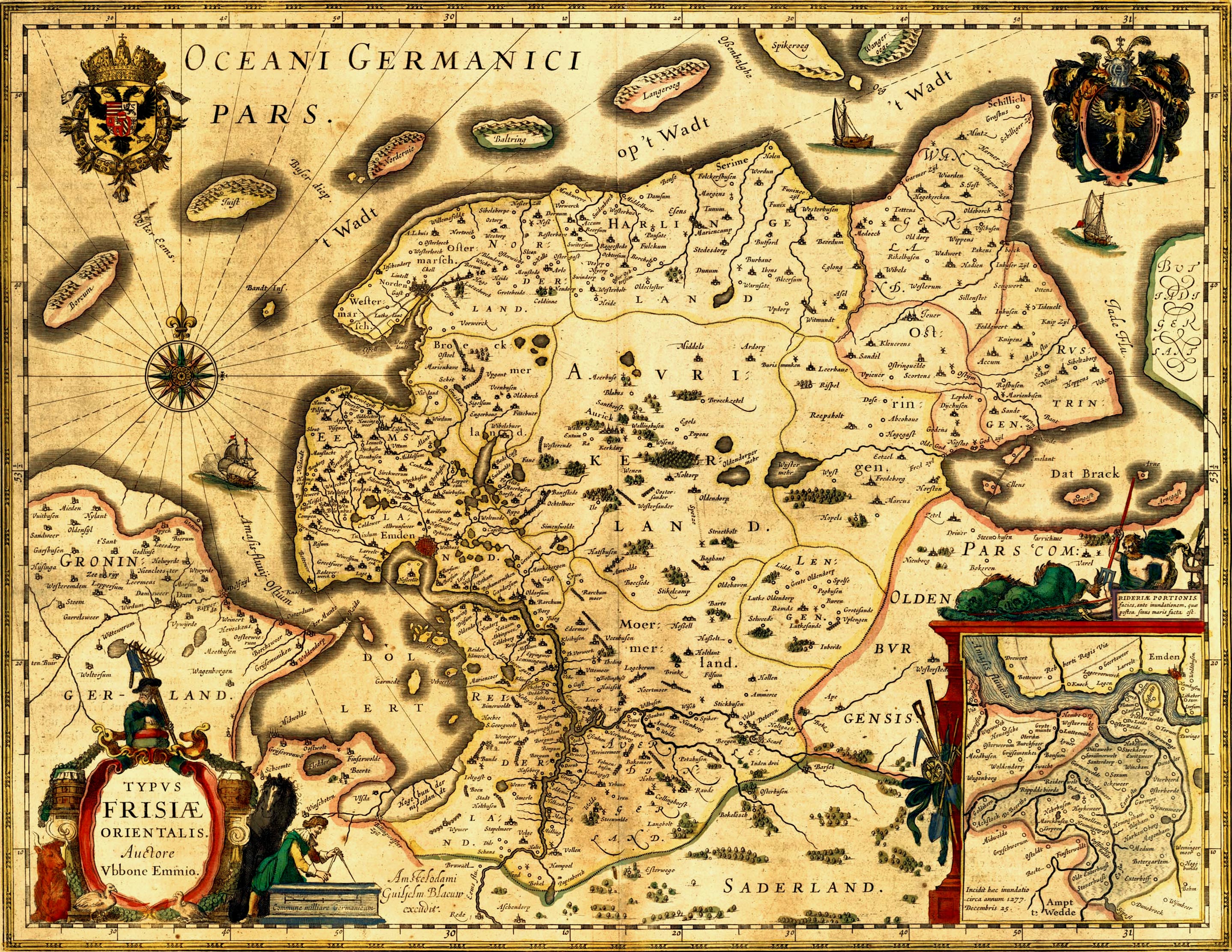
Deutsch: Alte Karte von Ostfriesland. English: Old map of East Frisia. Plattdüütsch: aulte landkoort vun Oostfreesland Español: mapa antigua de Frisia oriental |
|||||||||||||||||||||||
| Data | około 1600 | |||||||||||||||||||||||
| Źródło | http://www.library.ucla.edu/yrl/reference/maps/blaeu/frisiae.jpg (deprecated link) | |||||||||||||||||||||||
| Twórca |
|
|||||||||||||||||||||||
| Licencja (Ponowne użycie tego pliku) |
public domain because of age | |||||||||||||||||||||||
| Georeferencing | ||||||||||||||||||||||||
| Inne wersje |

Note: The colors may be adjusted again in the future. I did it on a TFT. ^.^ A 500dpi TIFF version can be ordered here: http://www.library.ucla.edu/yrl/reference/maps/blaeu/germania.htm (deprecated link) |
|||||||||||||||||||||||
.jpg)
|
Ten materiał przeszedł do domeny publicznej w kraju pochodzenia, jak również w państwach i terytoriach, gdzie prawo autorskie wygasa w ciągu 70 lat po śmierci autora.
| |
| Plik rozpoznano jako wolny od znanych ograniczeń praw autorskich, włącznie z prawami zależnymi i pokrewnymi. | |
Historia pliku
Kliknij na datę/czas, aby zobaczyć, jak plik wyglądał w tym czasie.
| Data i czas | Miniatura | Wymiary | Użytkownik | Opis | |
|---|---|---|---|---|---|
| aktualny | 00:03, 17 sty 2007 | | 2878 × 2225 (1,71 MB) | Enricopedia | {{Information |Description= {{de|Alte Karte von Ostfriesland.}}{{en|Old map of East Frisia.}} |Source= http://www.library.ucla.edu/yrl/reference/maps/blaeu/frisiae.jpg |Date=14th century |Author=[[:de:Ubbo Emmius|Ub |
Lokalne wykorzystanie pliku
Następujące strony korzystają z tego pliku:
Globalne wykorzystanie pliku
Ten plik jest wykorzystywany także w innych projektach wiki:
- Wykorzystanie na azb.wikipedia.org
- Wykorzystanie na da.wikipedia.org
- Wykorzystanie na de.wikipedia.org
- 1600
- Jadebusen
- Ostfriesland
- Dollart
- Norderney
- Cirksena
- Norden (Ostfriesland)
- Wittmund
- Bockhorn (Friesland)
- Arngast
- Sande (Friesland)
- Rüstringen
- Leybucht
- Harlebucht
- Geschichte Ostfrieslands
- Heppens
- Schwarzes Brack
- Neustadtgödens
- Auricherland
- Wikipedia:WikiProjekt Ostfriesland/Kartenzimmer
- Diskussion:Ostfriesland/Archiv/1
- Grafschaft Ostfriesland
- Steinhaus Bunderhee
- Antoniflut
- Diskussion:Norderney/Archiv/1
- Ostfriesland zur Zeit des Dreißigjährigen Krieges
- Wikipedia Diskussion:Hauptseite/Artikel des Tages/Archiv/Vorschläge/2010/1
- Wikipedia Diskussion:Hauptseite/Archiv/2010/Januar
- Portal:Ostfriesland/Ausgezeichnet
- Portal:Ostfriesland/EA
- Itzendorf
- Mariensiel
- Wikipedia Diskussion:WikiProjekt Ostfriesland/Archiv/2010
- Bucht von Sielmönken
- Maadebucht
- Herrlichkeit Gödens
- Crildumer Bucht
- Ellenser Damm
- Wikipedia Diskussion:Hauptseite/Artikel des Tages/Archiv/Vorschläge/2014/Q2
- Wikipedia:Hauptseite/Archiv/20. April 2014
- Hilgenrieder Bucht
- Vorlage:Navigationsleiste Meeresbuchten und ehemalige Meeresbuchten auf der Ostfriesischen Halbinsel
- Benutzer:GregorHelms/Falstertief
- Wykorzystanie na de.wikisource.org
- Wykorzystanie na en.wikipedia.org
Pokaż listę globalnego wykorzystania tego pliku.