
Wyspa Henrietty
Na mapach:  77°06′N 156°30′E/77,100000 156,500000
 Zdjęcie satelitarne wyspy, otoczonej lodem morskim | |
| Kontynent | |
|---|---|
| Państwo | |
| Republika | |
| Akwen | |
| Archipelag | |
| Powierzchnia |
12 km² |
Położenie na mapie Rosji 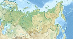 | |
Wyspa Henrietty (ros. Oстров Генриетты) – rosyjska wyspa na Morzu Wschodniosyberyjskim, w archipelagu Nowosyberyjskim, zaliczana do Wysp De Longa, położona najdalej na północ w tej grupie.
Wyspa ma powierzchnię 12 km², z tego 40% pokryte jest lodem. Została odkryta przez ekspedycję George'a De Longa na statku Jeannette.

Bibliografia[edytuj | edytuj kod]
- Anisimov, M.A., and V.E. Tumskoy, 2002, Environmental History of the Novosibirskie Islands for the last 12 ka. 32nd International Arctic Workshop, Program and Abstracts 2002. Institute of Arctic and Alpine Research, University of Colorado at Boulder, pp 23–25.
- Anonymous, 1923, Wrangel Island. The Geographical Journal, Vol. 62, No. 6. pp. 440–444 (Dec., 1923). (requires JSTOR access).
- Headland, R.K., 1994, OSTROVA DE-LONGA ('De Long Islands'). Scott Polar Research Institute, Cambridge University. Lasted visited May 26, 2008.
- Schirrmeister, L., H.-W. Hubberten, V. Rachold, and V.G. Grosse, 2005, Lost world - Late Quaternary environment of periglacial Arctic shelves and coastal lowlands in NE-Siberia. 2nd International Alfred Wegener Symposium Bremerhaven, October, 30 - November 2, 2005.