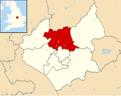
Charnwood (borough)
Na mapach: 52°46′08″N 1°12′14″W/52,769000 -1,204000
| dystrykt niemetropolitalny | |
 Loughborough | |
| Państwo | |
|---|---|
| Kraj | |
| Region | |
| Hrabstwo | |
| Siedziba | |
| Powierzchnia |
279 km² |
| Populacja (2016) • liczba ludności |
|
| • gęstość |
643 os./km² |
Położenie na mapie Leicestershire
| |
| Strona internetowa | |
Charnwood – dystrykt w hrabstwie Leicestershire w Anglii.
Miasta[edytuj | edytuj kod]
Inne miejscowości[edytuj | edytuj kod]
Anstey, Barkby, Barkby Thorpe, Barrow upon Soar, Beeby, Birstall, Burton on the Wolds, Cropston, East Goscote, Hathern, Hoton, Mountsorrel, Nanpantan, Newtown Linford, Quorn, Ratcliffe on the Wreake, Rearsby, Rothley, Seagrave, Sileby, South Croxton, Swithland, Thrussington, Thurcaston, Thurmaston, Ulverscroft, Walton on the Wolds, Wanlip, Woodhouse Eaves, Woodhouse, Wymeswold.
Przypisy[edytuj | edytuj kod]
- ↑ Population Estimates for UK, England and Wales, Scotland and Northern Ireland - Office for National Statistics [online], www.ons.gov.uk [dostęp 2017-10-22] (ang.).
