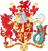
Carmarthenshire
Wygląd
Na mapach: 51°51′22″N 4°18′38″W/51,856111 -4,310556
| hrabstwo | |||

| |||
| |||
| Dewiza: Rhyddid gwerin, ffyniant gwlad (walijski: Wolność ludzi dobrem kraju) | |||
| Państwo | |||
|---|---|---|---|
| Księstwo | |||
| Siedziba | |||
| Powierzchnia |
2 395 km² | ||
| Populacja • liczba ludności |
| ||
| • gęstość |
74 os./km² | ||
Położenie na mapie Walii
| |||
| Strona internetowa | |||
Carmarthenshire (wal. Sir Gaerfyrddin) – hrabstwo w południowej Walii ze stolicą w Carmarthen. Graniczy od północy z Ceredigion, od wschodu z Powys, Neath Port Talbot i Swansea a od zachodu z Pembrokeshire.
Miejscowości[edytuj | edytuj kod]
Na terenie hrabstwa znajdują się następujące miejscowości[1][2] (w nawiasach liczba ludności w 2011[3]):
- Llanelli (43 878)
- Carmarthen (15 854)
- Ammanford (7945)
- Burry Port (6156)
- Pen-y-groes (5717)
- Glanaman (4384)
- Llangennech (4324)
- Tumble (4302)
- Tycroes (3752)
- Llandybie (2813)
- Kidwelly (2782)
- Brynamman (2608)
- Pembrey (2154)
- Llandovery (2065)
- St Clears (1989)
- Newcastle Emlyn (1883)
- Llandeilo (1795)
- Pontyberem (1695)
- Trimsaran (1584)
- Whitland (1514)
- Pontyates (1449)
- Pwll (1389)
- Waungilwen (1338)
- Llanybyther (1218)
- Penybanc (1126)
- Pencader (1107)
- Pont Henri (987)
- Cwmann (872)
- Llannon (869)
- Saron (867)
- Ferryside (846)
- Laugharne (817)
- Pwll-trap (674)
- Carway (672)
- Llangadog (650)
- Abergwili (589)
- Meidrim (582)
- Ffairfach (534)
- Nantgaredig (524)
- Blaenau (425)
- Llansteffan (424)
- Peniel (358)
- Pendine (346)
- Mynyddygarreg (299)
- Llanwrda (287)
- Pentre-cwrt (247)
Mapa[edytuj | edytuj kod]
Przypisy[edytuj | edytuj kod]
- ↑ a b Office for National Statistics: Built-up Area to Local Authority District (December 2011) Lookup in England and Wales. [w:] Open Geography Portal [on-line]. [dostęp 2022-06-05]. (ang.).
- ↑ a b Office for National Statistics: Built-up Area Sub Divisions (December 2011) Boundaries. [w:] Open Geography Potal [on-line]. [dostęp 2022-06-05]. (ang.).
- ↑ a b Office for National Statistics: KS101EW - Usual resident population. [w:] 2011 Census [on-line]. Nomis – Official labour market statistics, 2013-02-12. [dostęp 2022-06-05]. (ang.).
Kontrola autorytatywna (principal area of Wales):


