City of Westminster
| City | |||
 Pałac Westminsterski nocą widziany z południowego brzegu Tamizy | |||
| |||
| Dewiza: Custodi Civitatem Domine łac.: Panie, chronisz miasto | |||
| Państwo | |||
|---|---|---|---|
| Kraj | |||
| Region | |||
| Kod ISO 3166-2 |
GB-WSM | ||
| Burmistrz |
Ian Adams | ||
| Powierzchnia |
21,48 km² | ||
| Populacja (2016) • liczba ludności |
| ||
| • gęstość |
11 528 os./km² | ||
| Kod pocztowy |
WC2, SW1, SW7, W1, W2, W9, W10, NW1, NW6, NW8[2] | ||
Położenie na mapie Wielkiego Londynu
| |||
| Strona internetowa | |||


City of Westminster – gmina Wielkiego Londynu położona w środkowej części miasta, nad Tamizą, w sąsiedztwie City of London. Wraz z 11 innymi gminami wchodzi w skład tzw. Londynu Wewnętrznego. Władzę stanowi Rada Gminy Westminster (ang. Westminster City Council). W City of Westminster znajduje się, oprócz Buckingham Palace – oficjalnej siedziby króla, także większość centralnych instytucji rządowo-politycznych, ambasady, liczne teatry, kina, muzea, sklepy i główne siedziby wielu firm o zasięgu globalnym.
Historia
[edytuj | edytuj kod]Gminę utworzono w 1965 na podstawie ustawy London Government Act 1963[3] ze stołecznych gmin St Marylebone (ang. Metropolitan Borough of St Marylebone), Paddington (ang. Metropolitan Borough of Paddington) oraz Westminster (ang. Metropolitan Borough of Westminster), które utworzono w 1900 roku w ramach podziału hrabstwa Londyn (ang. County of London) na 28 gmin[4].
Geografia
[edytuj | edytuj kod]Gmina Westminster ma powierzchnię 21,48 km², graniczy od wschodu z City, od zachodu z Kensington and Chelsea, od północnego zachodu z Brent, od północnego wschodu z Camden zaś od południa przez Tamizę z Wandsworth i Lambeth.
W skład gminy Westminster wchodzą następujące obszary:
|
|
Gmina dzieli się na 18 okręgów wyborczych[5] które nie pokrywają się dokładnie z podziałem na obszary, zaś mieszczą się w dwóch rejonach tzw. borough constituencies – Westminster North i Cities of London and Westminster[6].
|
|
Demografia
[edytuj | edytuj kod]W 2011 roku gmina Westminster miała 219 396 mieszkańców[7].
Podział mieszkańców według grup etnicznych na podstawie spisu powszechnego z 2011 roku[8]:
|
|
Podział mieszkańców według wyznania na podstawie spisu powszechnego z 2011 roku[9]:
- Chrześcijaństwo – 44,6%
- Islam – 18,3%
- Hinduizm – 1,9%
- Judaizm – 3,3%
- Buddyzm – 1,5%
- Sikhizm – 0,2%
- Pozostałe religie – 0,6%
- Bez religii – 20,3%
- Nie podana religia – 9,4%
Podział mieszkańców według miejsca urodzenia na podstawie spisu powszechnego z 2011 roku[10]:
|
|
Transport
[edytuj | edytuj kod]


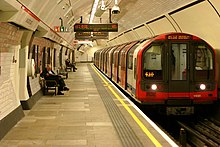
Przez dzielnicę Westminster przebiega 10 z 11 linii metra: Bakerloo Line, Central Line, Circle Line, District Line, Hammersmith & City Line, Jubilee Line, Metropolitan Line, Northern Line, Piccadilly line i Victoria Line.
Stacje metra:
- Baker Street – Bakerloo Line, Circle Line, Hammersmith & City Line, Jubilee Line i Metropolitan Line
- Bayswater – Circle Line i District Line
- Bond Street – Central Line i Jubilee Line
- Charing Cross – Bakerloo Line i Northern Line
- Covent Garden – Piccadilly line
- Edgware Road – Bakerloo Line
- Edgware Road – Circle Line, District Line i Hammersmith & City Line (druga stacja o tej samej nazwie położona 150 metrów dalej)
- Embankment – Bakerloo Line, Circle Line, District Line i Northern Line
- Great Portland Street – Circle Line, Hammersmith & City Line i Metropolitan Line
- Green Park – Jubilee Line, Piccadilly line i Victoria Line
- Hyde Park Corner – Piccadilly line
- Knightsbridge (na granicy z Kensington and Chelsea) – Piccadilly line
- Lancaster Gate – Central Line
- Leicester Square – Northern Line i Piccadilly line
- Maida Vale – Bakerloo Line
- Marble Arch – Central Line
- Marylebone – Bakerloo Line
- Oxford Circus – Bakerloo Line, Central Line i Victoria Line
- Paddington – Bakerloo Line, Circle Line, District Line i Hammersmith & City Line
- Piccadilly Circus – Bakerloo Line i Piccadilly line
- Pimlico – Victoria Line
- Queensway – Central Line
- Regent’s Park – Bakerloo Line
- Royal Oak – Circle Line i Hammersmith & City Line
- St. James’s Park – Circle Line i District Line
- St John’s Wood – Jubilee Line
- Temple – Circle Line i District Line
- Tottenham Court Road (na granicy z Camden) – Central Line i Northern Line
- Victoria – Circle Line, District Line i Victoria Line
- Warwick Avenue – Bakerloo Line
- Westbourne Park (na granicy z Kensington and Chelsea) – Circle Line i Hammersmith & City Line
- Westminster – Circle Line, District Line i Jubilee Line
Pasażerskie połączenia kolejowe na terenie Westminster obsługują przewoźnicy Southern, Southeastern, Chiltern Railways, First Great Western, Heathrow Connect i Heathrow Express.
Stacje kolejowe:
Mosty:
Tramwaje wodne – Thames Clippers[11]
Przystanie:
- Embankment Pier
- Millbank Millennium Pier
Miejsca i muzea
[edytuj | edytuj kod]


- Pałac Westminsterski
- Big Ben
- Buckingham Palace
- Clarence House
- St. James’s Palace
- St. James’s Park
- Downing Street – 10 Downing Street
- Royal Courts of Justice (siedziba sądów wyższej instancji)
- Whitehall – Foreign and Commonwealth Office
- Royal Geographical Society
- Somerset House
- Opactwo Westminsterskie
- Katedra Westminsterska
- National Gallery w Londynie
- National Portrait Gallery
- Household Cavalry Museum[12]
- Handel House Museum[13]
- Tate Britain
- Muzeum Figur Woskowych Madame Tussaud w Londynie
- London Transport Museum[14]
- The Guards Museum[15]
- Churchill War Rooms[16] (muzeum: bunkier, gdzie w czasie II wojny odbywały się posiedzenia rządu Winstona Churchilla)
- Alexander Fleming Laboratory Museum[17]
- Apsley House (Wellington Museum)[18]
- Sherlock Holmes Museum[19]
- Instytut Polski i Muzeum im. gen. Sikorskiego w Londynie
- Spencer House[20]
- Wallace Collection
- Muzeum/sklep firmy Twinings (pierwsza herbaciarnia w Londynie)[21]
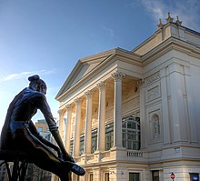
- Royal Opera House
- English National Opera
- Royal Albert Hall
- kilkadziesiąt teatrów w dzielnicy West End
- Lord's Cricket Ground/MCC Museum[22]
- Hotel Savoy
- Trafalgar Square
- Piccadilly Circus
- Hyde Park
- London Zoo
- Abbey Road Studios
- Victoria Coach Station
- Wellington Arch
- Carnaby Street[23] (deptak z dużą ilością butików w dzielnicy Soho)
- Oxford Street
- rejs tramwajem wodnym po Regent’s Canal z Little Venice (Maida Vale) do Camden Lock (Camden Town)[24]
- Battle of Britain Monument
- Igła Kleopatry (ang. Cleopatra's Needle) (egipski obelisk zwany Igłą Kleopatry. Do Anglii przywieziono go w 1878 r. Wznosi się niedaleko Waterloo Bridge[25])
Edukacja
[edytuj | edytuj kod]

- Royal Academy of Arts
- Imperial College London (na granicy z Kensington and Chelsea)
- King’s College (kampus Strand)
- trzy uczelnie wchodzące w skład University of the Arts London[26]: London College of Fashion, Central Saint Martins College of Art and Design i Chelsea College of Art and Design
- trzy uczelnie wchodzące w skład Uniwersytetu Londyńskiego: London Business School[27], London School of Economics, Królewska Akademia Muzyczna
- University of Westminster[28]
- City of Westminster College[29]
- Westminster Kingsway College- jeden z dwóch kampusów znajduje się w Victorii[30]
- Regent’s College[31]
- The Royal College of St. Peter in Westminster (Westminster School)[32] – elitarna prywatna szkoła która wraz z czterema innymi szkołami: Paul’s Girls' School z Hammersmith and Fulham, St Paul’s School z Richmond upon Thames, Hills Road Sixth Form College z Cambridge oraz Eton College z Eton/Berkshire w latach 2007–2009 wysłały 946 absolwentów na uniwersytety Cambridge i Oxford, podczas gdy pozostałe 2000 szkół wysłało łącznie 927 wychowanków[33]
- Royal College Of Music[34]
- London International College[35]
- Westminster City School[36]
- Abbey College[37]
- London School Of Marketing[38]
- London Film School[39]
- St Patricks International College[40]
- West London College[41]
- American InterContinental University (London)[42]
- Westminster Academy[43]
Letnie Igrzyska Olimpijskie 2012
[edytuj | edytuj kod]
W ramach Letnich Igrzysk Olimpijskich 2012 na terenie gminy Westminster odbyły się zawody w następujących miejscach[44]:
- Horse Guards Parade (siatkówka plażowa)
- Hyde Park (pływanie na otwartym akwenie, triathlon)
- Lord's Cricket Ground (łucznictwo)
- The Mall – odcinek łączący Buckingham Palace z Trafalgar Square (start i meta kolarstwa szosowego, maratonu oraz chodu)
Znane osoby
[edytuj | edytuj kod]W City of Westminster urodzili się m.in.:
- Kiefer Sutherland – aktor
- Alec Guinness – aktor
- Seal – piosenkarz
- Henry Gray – chirurg i anatom
- Alan Mathison Turing – matematyk i kryptolog
- Joan Collins – aktorka
- Wilhelm, książę Walii – członek brytyjskiej rodziny królewskiej, następca brytyjskiego tronu
- Henryk z Walii – członek brytyjskiej rodziny królewskiej
- Cat Stevens – wokalista i kompozytor
- Adam Ant – wokalista i gitarzysta
- Emma Thompson – aktorka i scenarzystka
- Corin Redgrave – aktor
- Robert Baden-Powell – wojskowy i pisarz
- Alfred Molina – aktor
- Elvis Costello – muzyk
- Les Ferdinand – piłkarz
- Douglas Douglas-Hamilton, 14. książę Hamilton – polityk i lotnik
- Steve Hackett – gitarzysta
- Michael Page – bokser oraz zawodnik MMA
Przypisy
[edytuj | edytuj kod]- ↑ Population Estimates for UK, England and Wales, Scotland and Northern Ireland - Office for National Statistics [online], ons.gov.uk [dostęp 2017-10-16] (ang.).
- ↑ „London postcodes”. [dostęp 2011-10-09]. [zarchiwizowane z tego adresu (2006-11-04)].
- ↑ „ Legislation.gov.uk- London Government Act 1963”
- ↑ „ hansard.millbanksystems.com-London Government Act 1899”
- ↑ „Westminster City Council- Ward Information”
- ↑ „ukpollingreport.co.uk-london”
- ↑ „ons.gov.uk – 2011 Census: KS102EW Age structure, local authorities in England and Wales”
- ↑ „ons.gov.uk – 2011 Census: KS201EW Ethnic group, local authorities in England and Wales”
- ↑ „ons.gov.uk – 2011 Census: KS209EW Religion, local authorities in England and Wales”
- ↑ „ons.gov.uk – 2011 Census: KS204EW Country of birth, local authorities in England and Wales”
- ↑ „Thames Clippers”
- ↑ „householdcavalrymuseum.co.uk – Household Cavalry Museum”
- ↑ „handelhouse.org – The Handel House Museum”
- ↑ „ltmuseum.co.uk – London Transport Museum”
- ↑ „theguardsmuseum.com – The Guards Museum”
- ↑ „cwr.iwm.org.uk – Churchill War Rooms”. [dostęp 2011-10-06]. [zarchiwizowane z tego adresu (2015-10-25)].
- ↑ „imperial.nhs.uk – Alexander Fleming Laboratory Museum”. [dostęp 2011-10-06]. [zarchiwizowane z tego adresu (2013-04-14)].
- ↑ „english-heritage.org.uk – Apsley House”
- ↑ „sherlock-holmes.co.uk – Sherlock Holmes Museum”
- ↑ „spencerhouse.co.uk – Spencer Hous”
- ↑ „twinings.co.uk – Twinings, 216, Strand, London”
- ↑ „lords.org – MCC Museum”. [dostęp 2014-09-10]. [zarchiwizowane z tego adresu (2016-03-05)].
- ↑ „carnaby.co.uk – Carnaby Street”
- ↑ „londonwaterbus.co.uk – London Waterbus Company”
- ↑ „archiwum.wiz.pl – Wiedza i Życie 1/1998”. [dostęp 2020-02-24]. [zarchiwizowane z tego adresu (2020-02-24)].
- ↑ „arts.ac.uk – University of the Arts London”
- ↑ „london.edu – London Business School”
- ↑ „westminster.ac.uk – University of Westminster”
- ↑ „cwc.ac.uk – City of Westminster College”
- ↑ „westking.ac.uk – Westminster Kingsway College”
- ↑ „regents.ac.uk – Regent's College”
- ↑ „westminster.org.uk – The Royal College of St. Peter in Westminster”
- ↑ „BBC – Five schools 'send more to Oxbridge than 2,000 others”
- ↑ „rcm.ac.uk – Royal College Of Music”
- ↑ „londonic.org.uk – London International College”
- ↑ „wcsch.com – Westminster City School”
- ↑ „abbeylondon.co.uk – Abbey College”. [dostęp 2011-11-21]. [zarchiwizowane z tego adresu (2011-11-24)].
- ↑ „londonschoolofmarketing.com – London School Of Marketing”
- ↑ „lfs.org.uk – London Film School ”
- ↑ „st-patricks.ac.uk – St Patricks International College”
- ↑ „westlondoncollege.com – West London College”
- ↑ „aiuniv.edu – American InterContinental University”
- ↑ „westminsteracademy.net – Westminster Academy”
- ↑ „london2012.com -venues”

